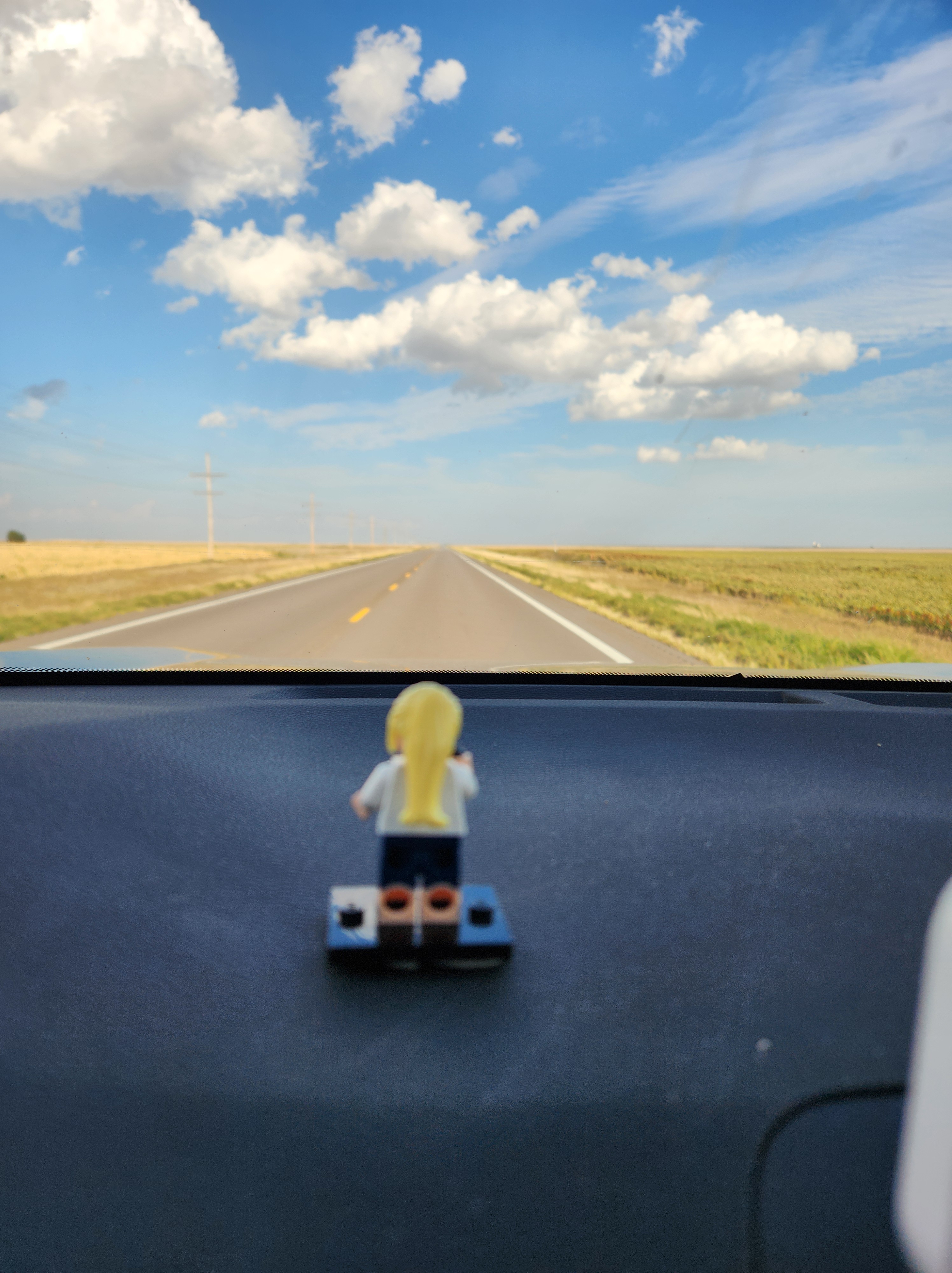
The road trip. A uniquely American ritual. A tank of gas, Google Maps with a general route planned, a bag of unhealthy food, always including gummy bears among other treats, Minifig MJ perched on my dashboard, and I was ready to go. My destination: Iowa. My route: a meandering path through eastern Colorado, Kansas, northeastern Missouri, and southeastern Iowa defined by a list of interesting and unusual roadside attractions curated from Roadside America and Atlas Obscura.
Having nothing but time is a beautiful gift. The freedom to take as much time along the way as needed. Not compelled to rush to a destination. Even more of a gift to me at this point in my life is taking a solo road trip. A sense of freedom to make an unplanned stop, a turn down a gravel road just because, or choosing two-lane roads over the Interstate.
On a clear, sunny Friday morning, I left Denver with my windows down and my music turned up.
I marked the beginning of my road trip with a right turn onto Colfax Avenue in Denver. Colfax Avenue is the “longest, wickedest street in America”. 53 miles long, it spans the entirety of the Denver metro area and extends out onto the plains. As I worked my way eastward across the city, I took in the skyline, the stadium, the capitol building, the old architecture of the Fox theater and an original McDonalds building. I admired the cityscape for what it was and not as someone that had lived there for the past 29 years. By the time Colfax dumped me onto I-70 East, the mountains were fading in my rear-view mirror. By the time I reached Strasbourg a short distance later, the mountains had all but disappeared. All that lay ahead of me was the vast expanse of prairie.
The first day of the road trip was more driving than stopping to see the places on my list. Partly because there just isn’t a lot out on the flat, dry plains of eastern Colorado. That, and my first two stops were closed for the season. The Comanche Crossing site, where the people of Strasbourg contend was the site of the true “golden spike” of the first continuous transcontinental railroad (sorry Utah, people still had to get off the train to cross the Missouri when your spike was driven) and the Kit Carson County Carousel in Burlington only operate in June, July, and August, as I was informed by the signs at the respective locations. Regardless, seeking out the sites made for nice detours off the Interstate and on to the smaller roads and through towns I had never stopped in.
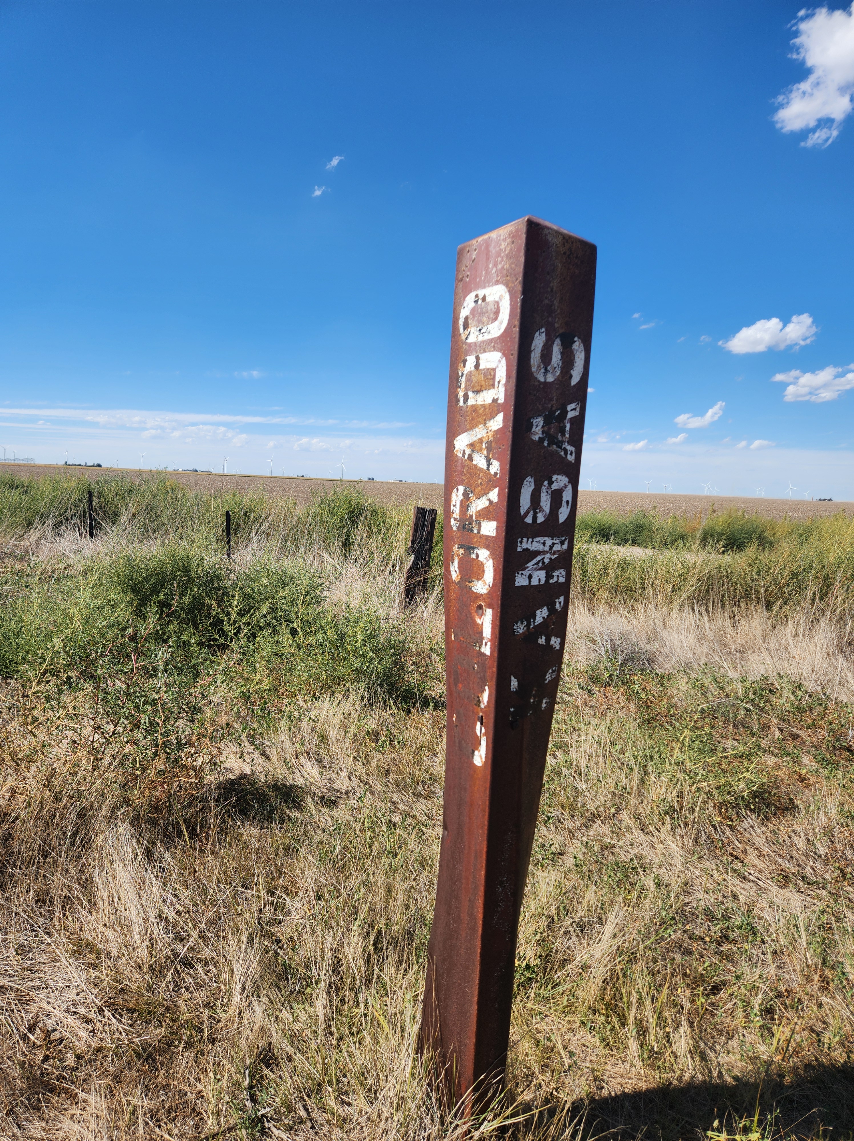
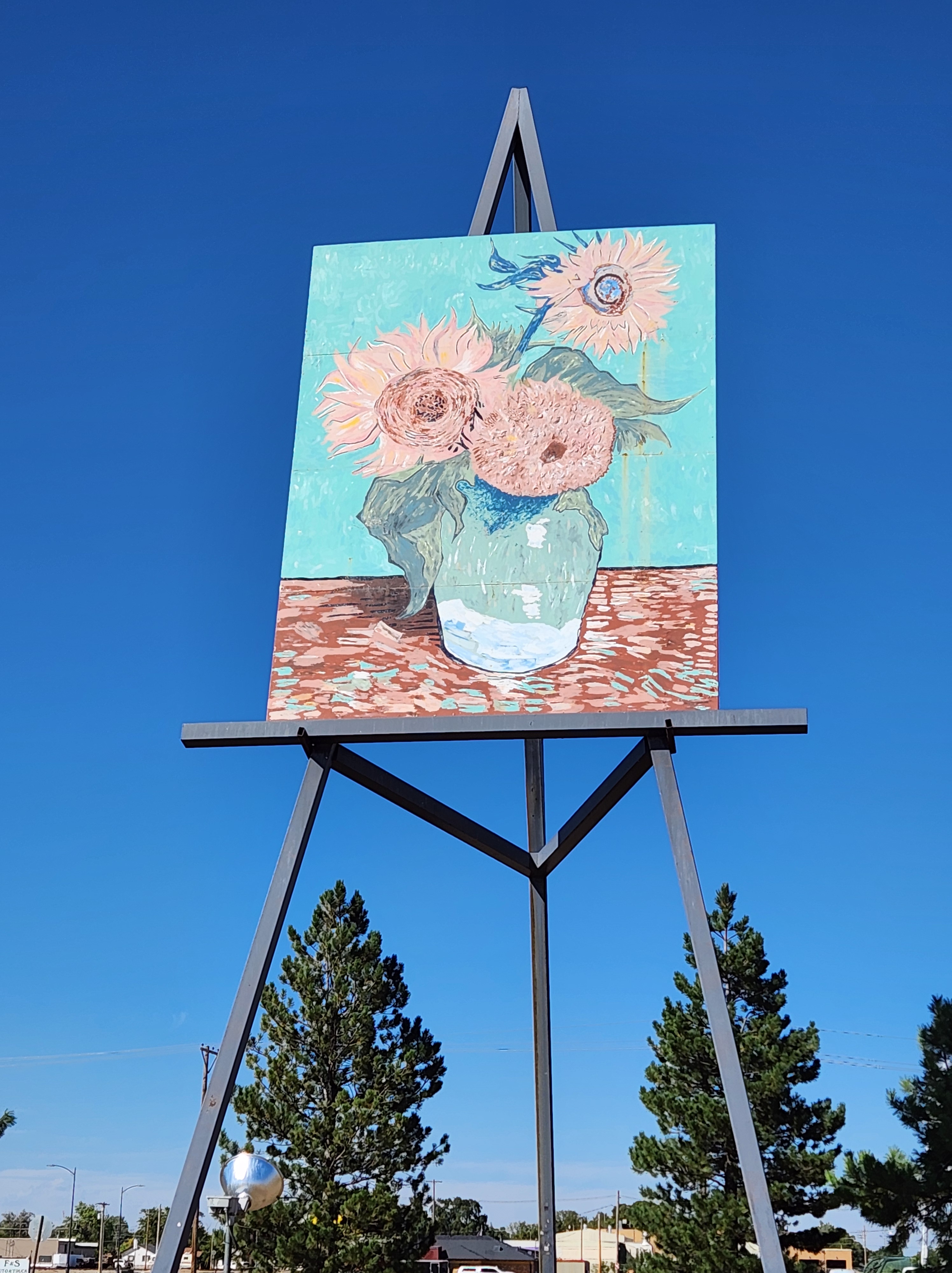
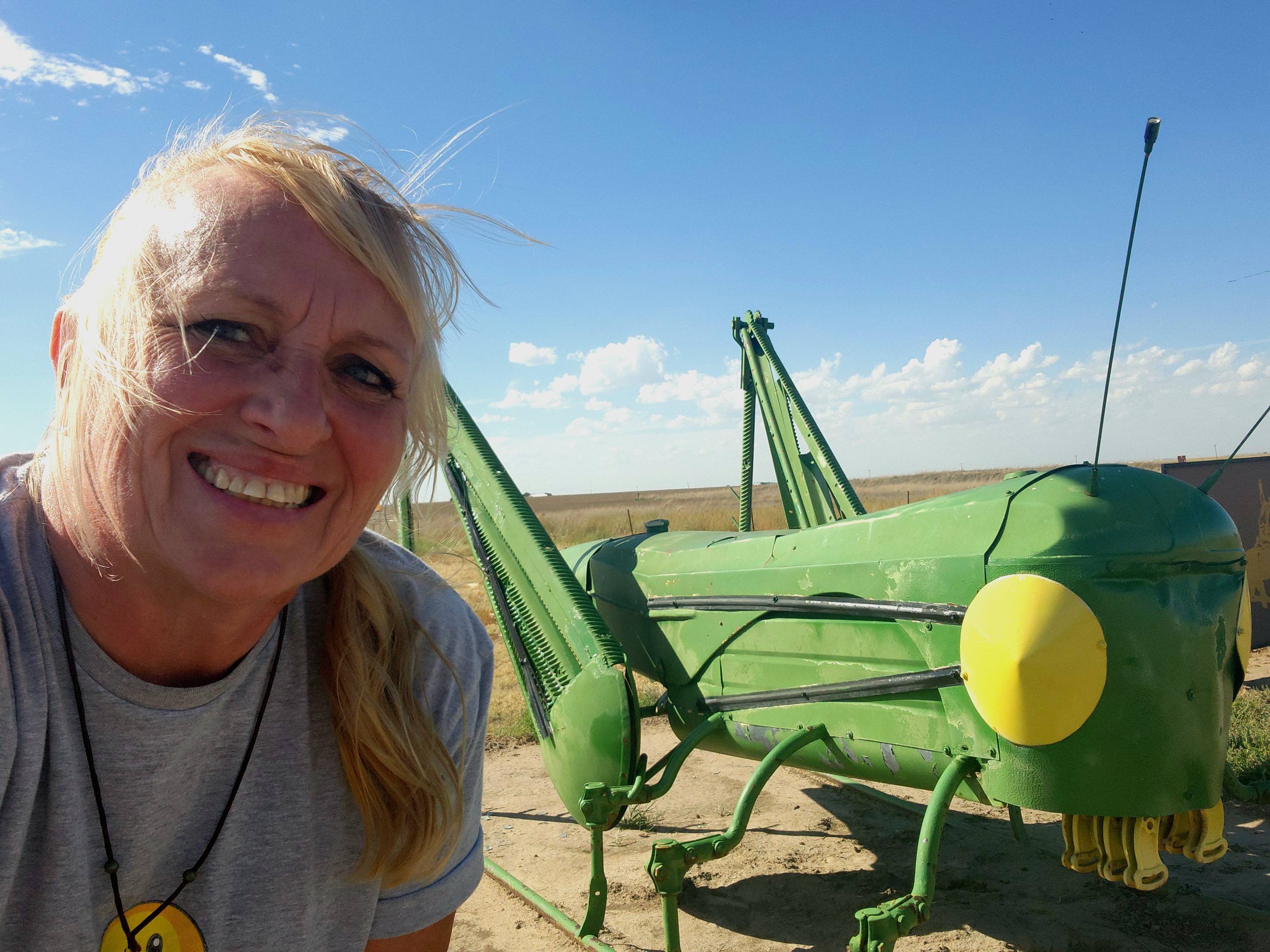
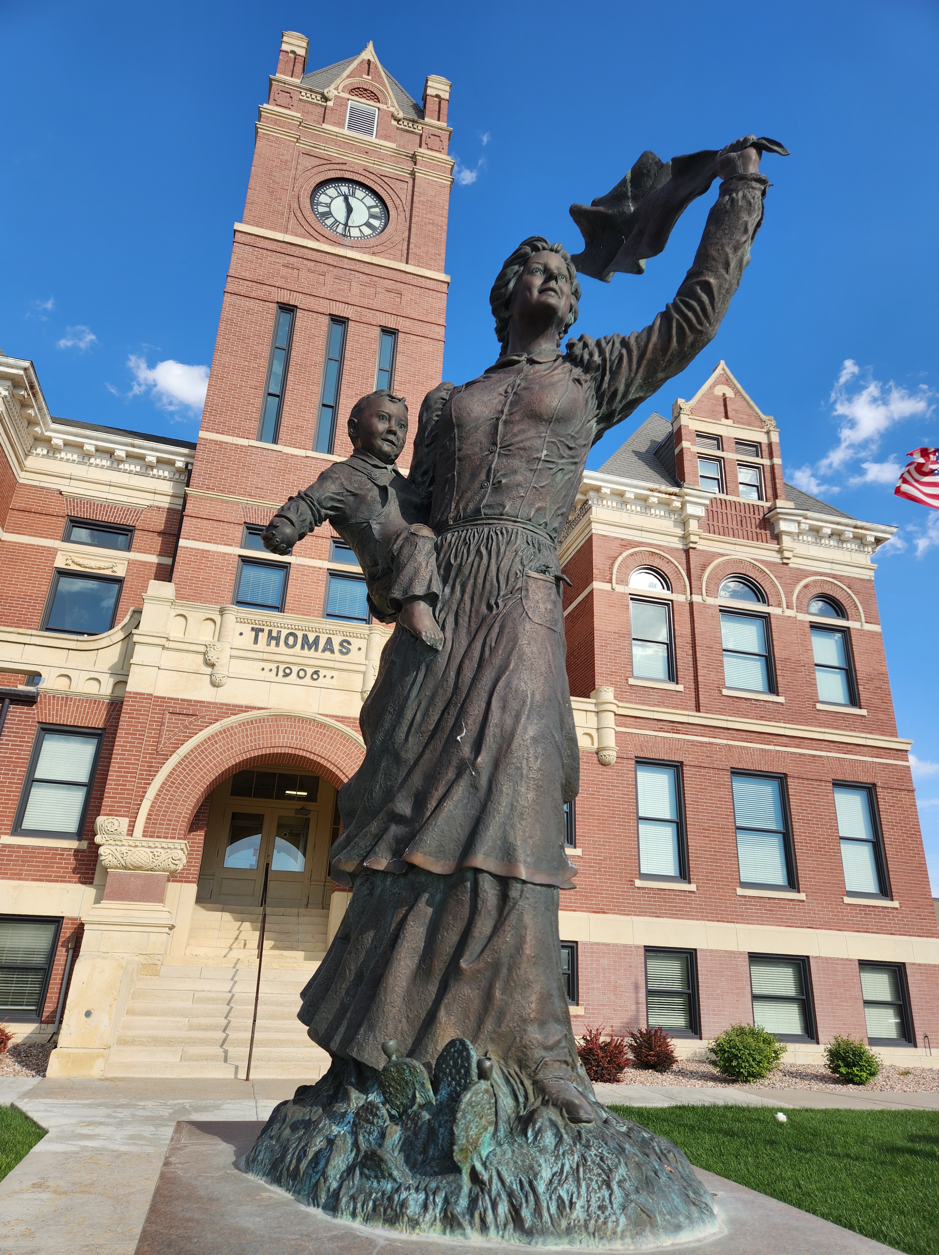
Entering Kansas, my success at visiting sites increased and my time on the Interstate decreased. The old Colorado-Kansas state line marker in Kanorado, just off US Highway 24 and across the train tracks running parallel to the road, is twisted and rusted, paint fading, showing the years it has marked that geographic designation. In Goodland, I admired an overly large painting of Van Gogh’s sunflowers perched atop the World’s Largest Easel, then sought out a grasshopper made out of John Deere tractor parts several miles north of the city. At Colby, I left the Interstate behind and continued east on US Highway 24. In Colby, I paused to admire the Spirit of the Prairie statue, a monument to the women that settled there. Passing through Hoxie, I took note of an interesting building and circled around to check it out. The manager of the museum, though on her way to the grocery store, saw me stop and then proceeded to give me a personal guided tour of their fantastic collection of the history of Sheridan County, Kansas.
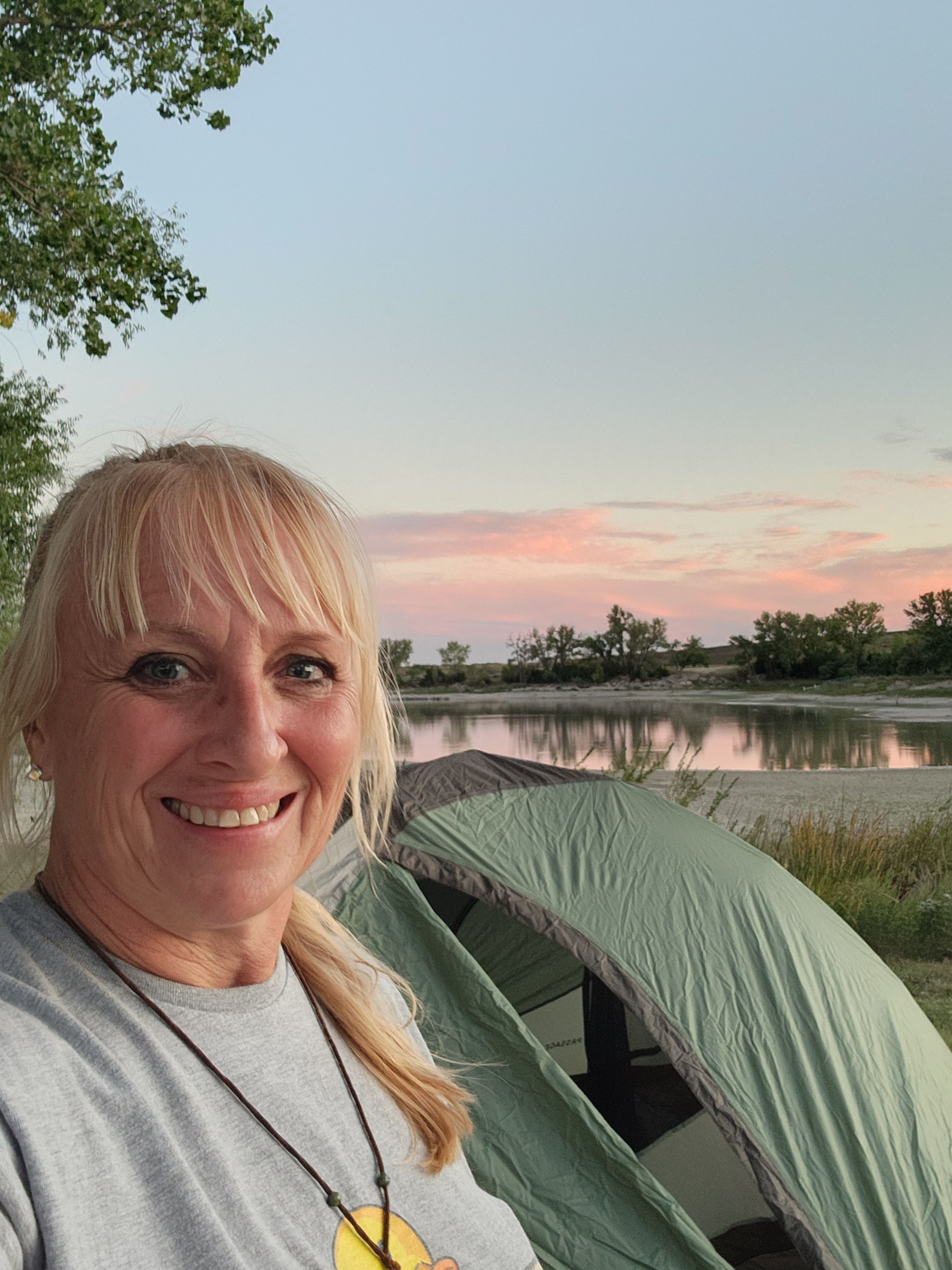
Forgetting about the change to the Central Time Zone when I was making my plans and setting my intentions for how far I would get that day and the unplanned stop at the Sheridan County History Museum, I didn’t actually make it as far as I thought I would. The weather was nice and I had the gear for camping, so on the recommendation of Karen (the manager of the museum) as far as places to camp, I headed for the Sheridan State Fishing Lake. The lake is off the highway and looking across the fields, you wouldn’t know it was there unless you saw the sign for it. As the lake is in the process of being drained for “repairs”, I was the only one in the whole park. I set up camp for the night, settling for a bologna and cheese sandwich instead of soup as what I though would work as a converter in my car didn’t work for my mini wannabe Keurig to heat the water, and watched a beautiful sunset of pinks and yellows reflected in the last vestiges of the water in the lake. Once in my tent, I tried to embrace the array of nature sounds that is foreign to the ears of someone that has been living in the city for too long, googled what wildlife was in the area that might eat me, ignored my thoughts of being so alone and no one actually knowing where I was, and drifted off to fitful sleep. Who knew that waterfowl were so active at night and also sound like people wading in water as they move about.


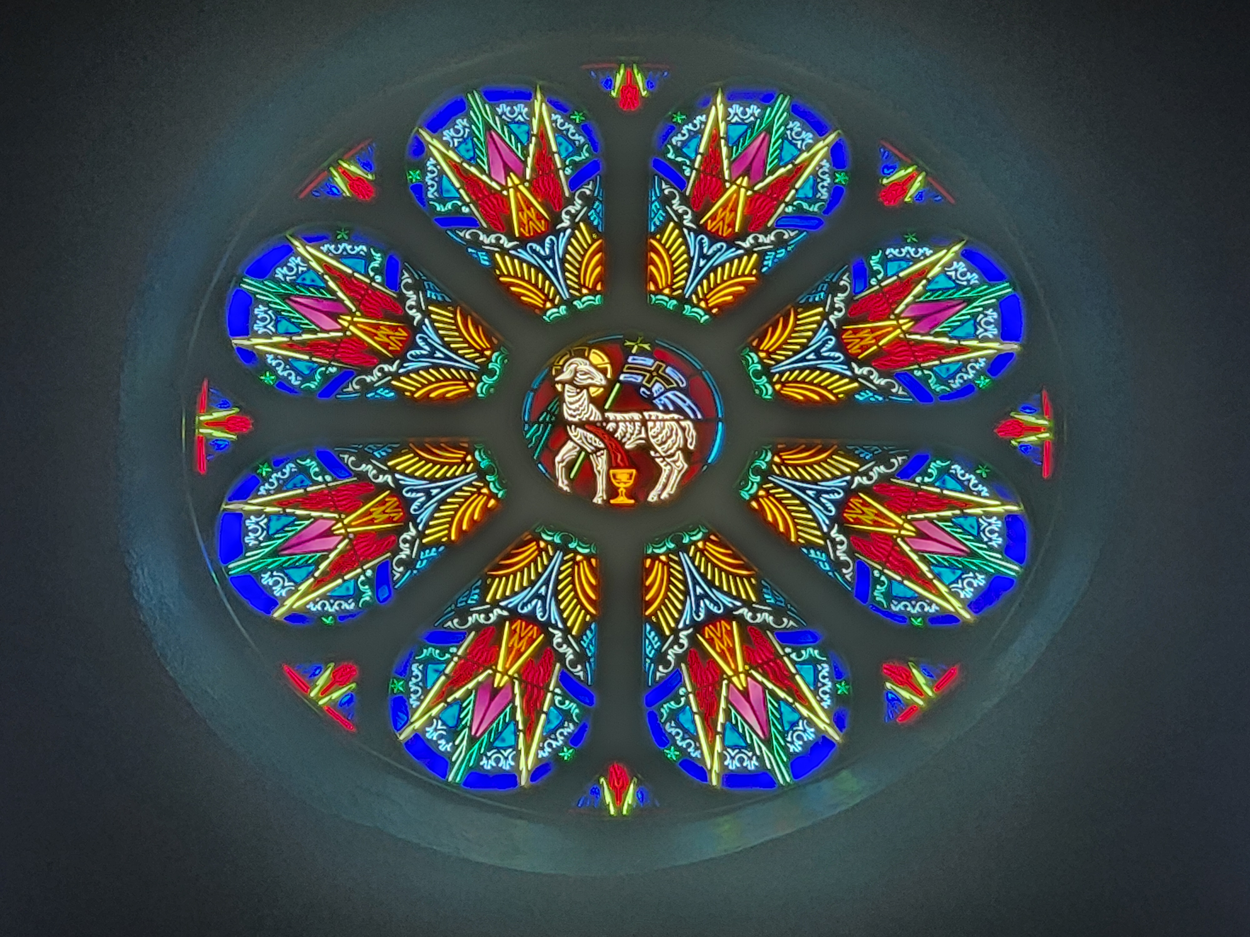
Continuing on at the light of day, actually closer to 10 AM by the time I packed everything up, I stopped for a much needed cup of coffee at the first town and was on my way again. Banishing the thought that I needed to “make up time” and embracing that it didn’t matter if it took me 3 days or 4 days to get to Iowa, I settled into my itinerary. Nicodemus, the first all black settlement drawing freed slaves from Kentucky and other lush areas to the dry barren expanse of Kansas with promises of autonomy and prosperity, is now more of a ghost town with 20 inhabitants and the site is a well curated National Park. Then on to Damar, a French Canadian settlement where St. Joseph Catholic Church rises up from the land so that you can see it from miles away. The high gothic ceilings and vibrant stained glass windows didn’t disappoint.
As I drove through the generally flat and brown countryside on the two lane roads, I pondered the determination and fortitude it took to settle on the harsh plains of Kansas. Dry and not at all lush like their homes on the East coast or Europe. The resilience they had to make a new life and the freedom the move represented.
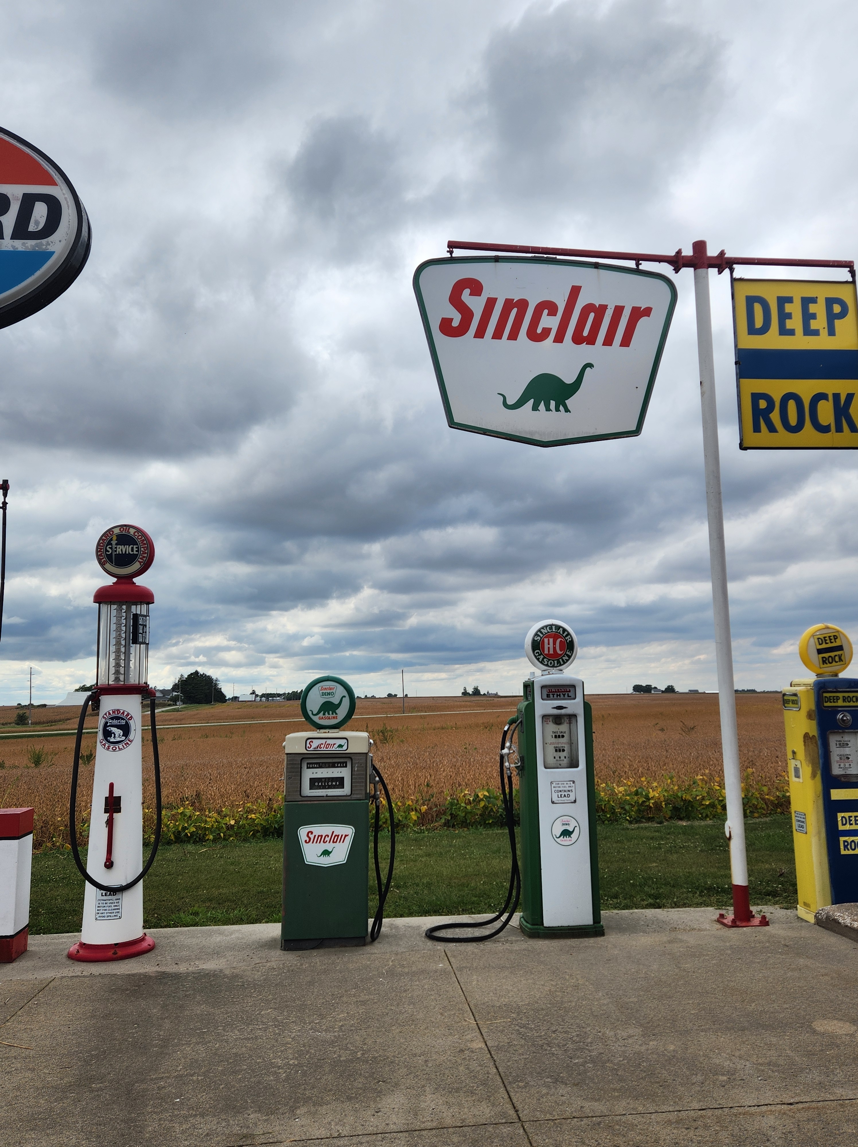
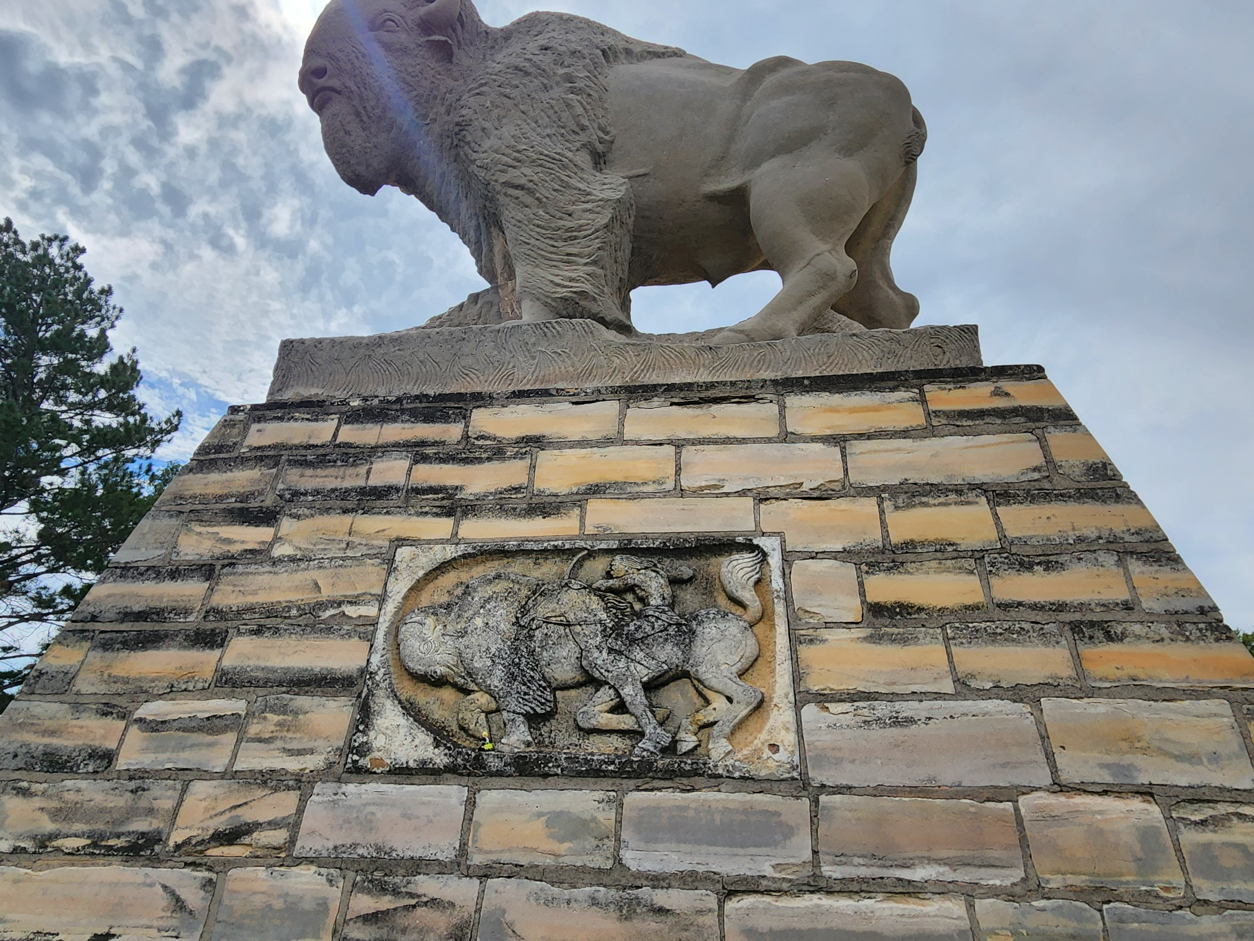
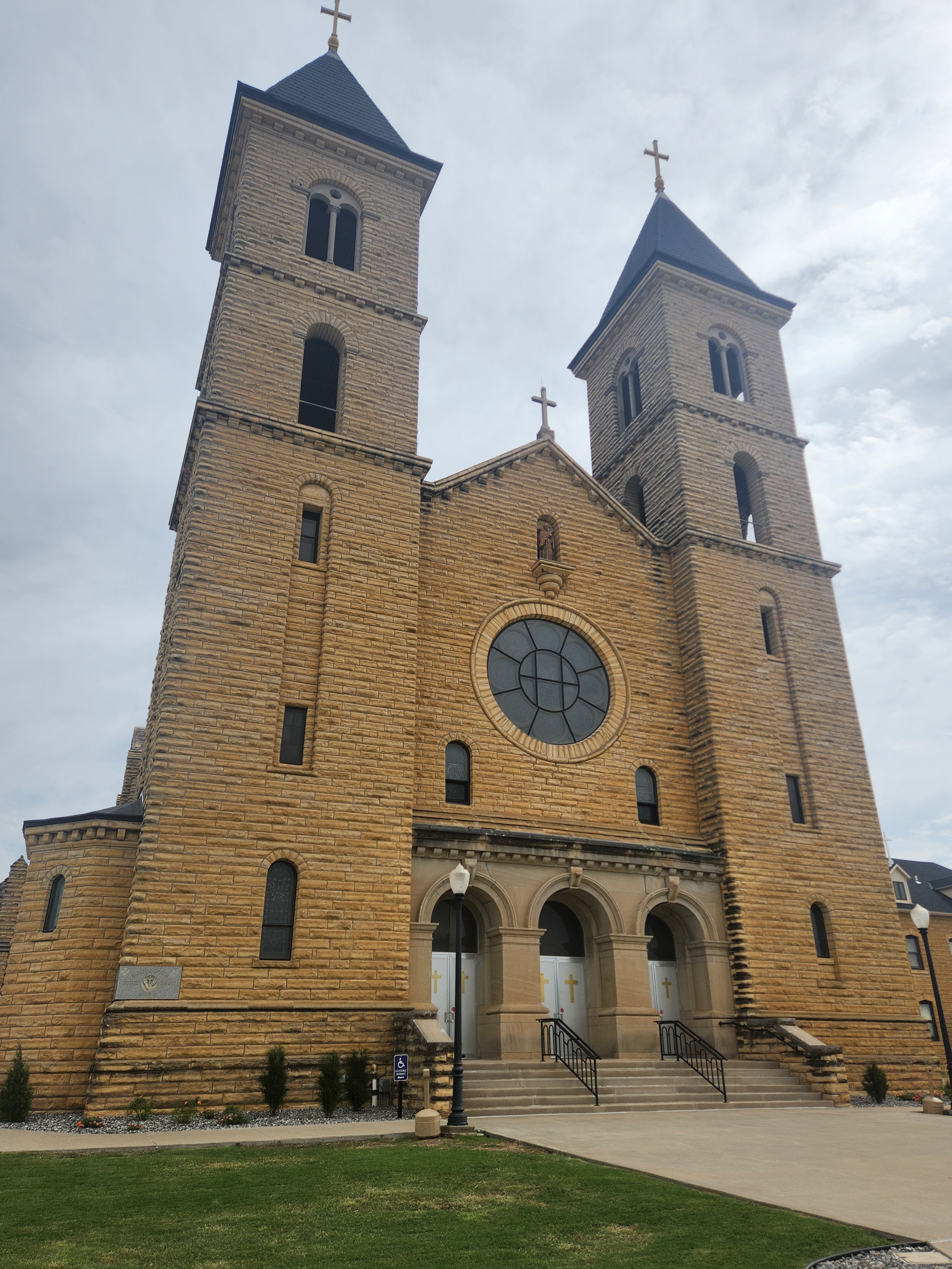
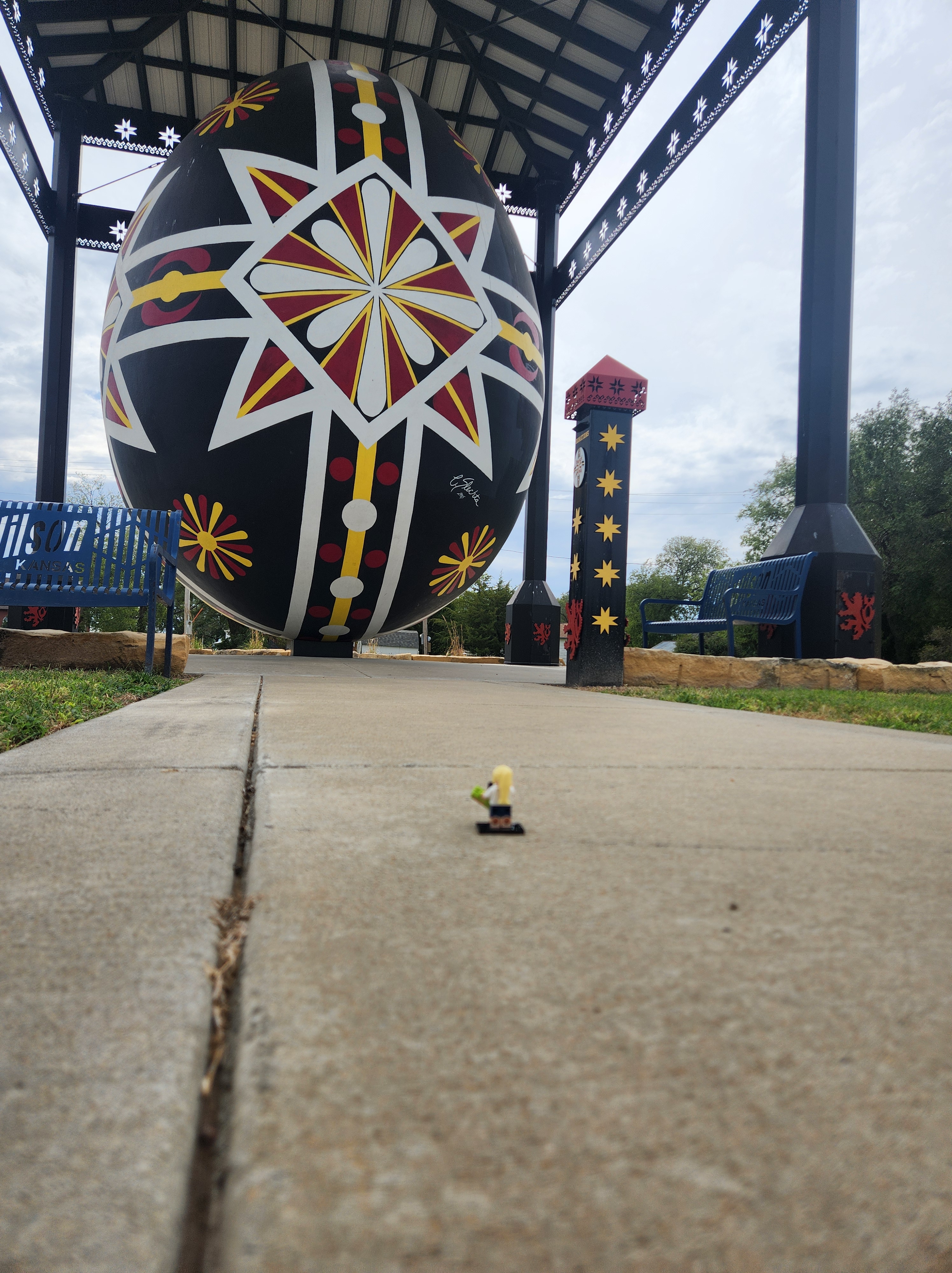
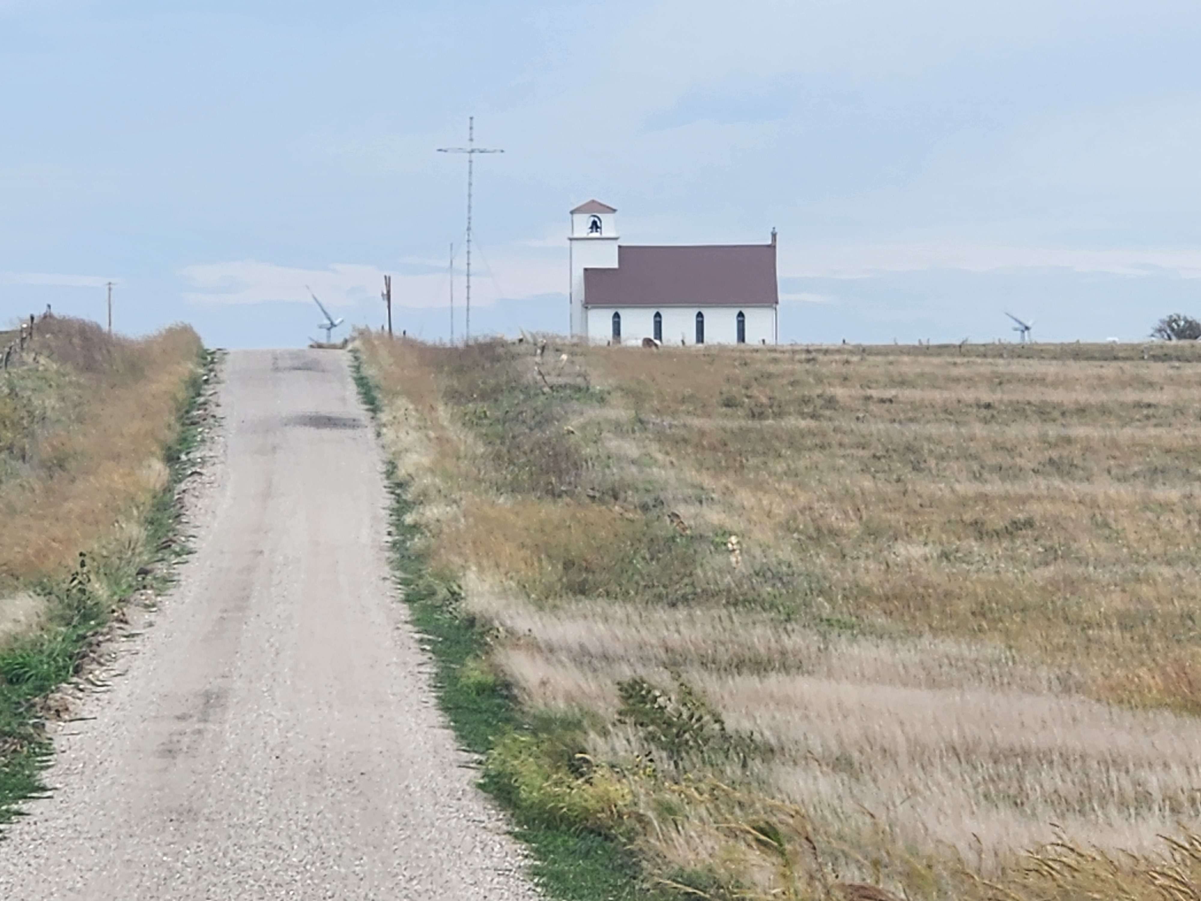
In Hays, I stopped to see Boot Hill, a place where over 80 people that “died with their boots on” including murderers, horse thieves, and loose women are buried. Hays also boasts a giant 18-ton stone bison keeping watch over Fort Hays and a heard of live bison that includes a leucistic (all white) bison calf. Turning left, I pressed eastward on to Victoria, home to a monument to 6 railroad workers that had been massacred by Indians and St. Fidelis Basilica (which I didn’t get to go into because of a wedding taking place.) Turning north, I stopped in Bunker Hill, which boasts an antique 1930’s Mobil gas station with mannequins frozen in a tableau reminiscent of the era, including superman in the phone booth and customers in the store. I ate my lunch of another bologna sandwich and potato chips while listening to the quiet of the city punctuated by the sounds of kids playing at the playground. Heading back south to Wilson, I admired the World’s Largest Hand-painted Czech Egg standing 22 feet tall with red and white decorations on a black background. My route then took me east, down some small roads that crisscross the prairie amongst the tall white windmills that stand like alien sentries over the land and which sound incredibly eerie when you stand near the base of one. Approaching Excelsior Church, perched on the top of a small hill in the middle of wheat fields, was just as picturesque as I thought it would be, complete with dramatic gray clouds pierced by the little white steeple.
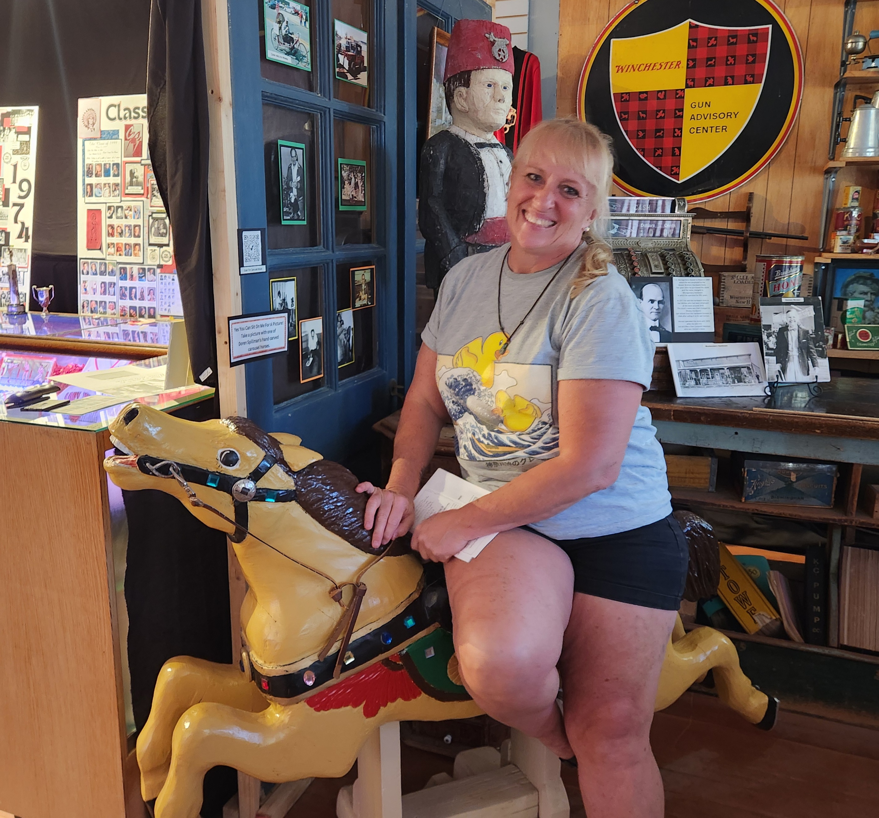
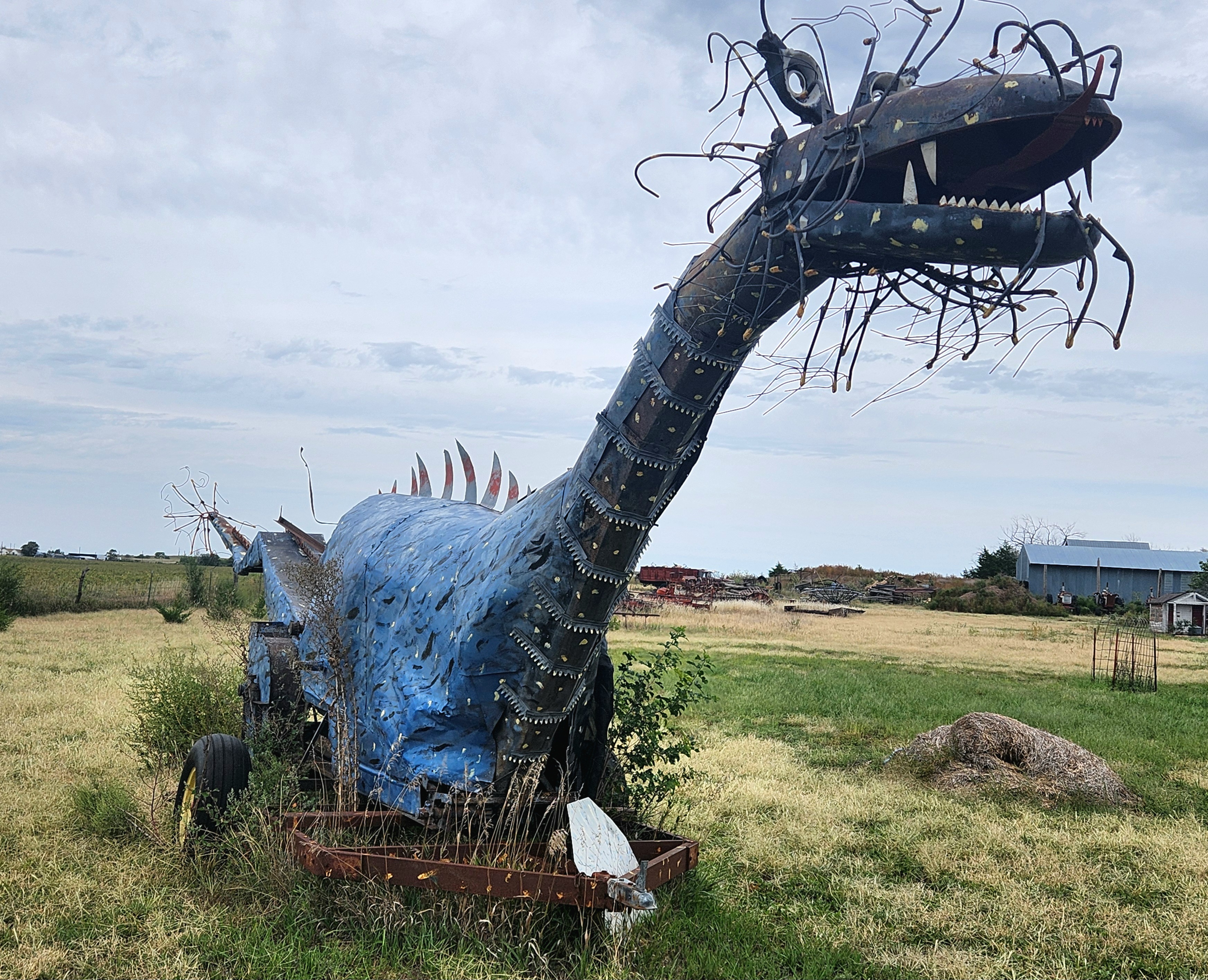
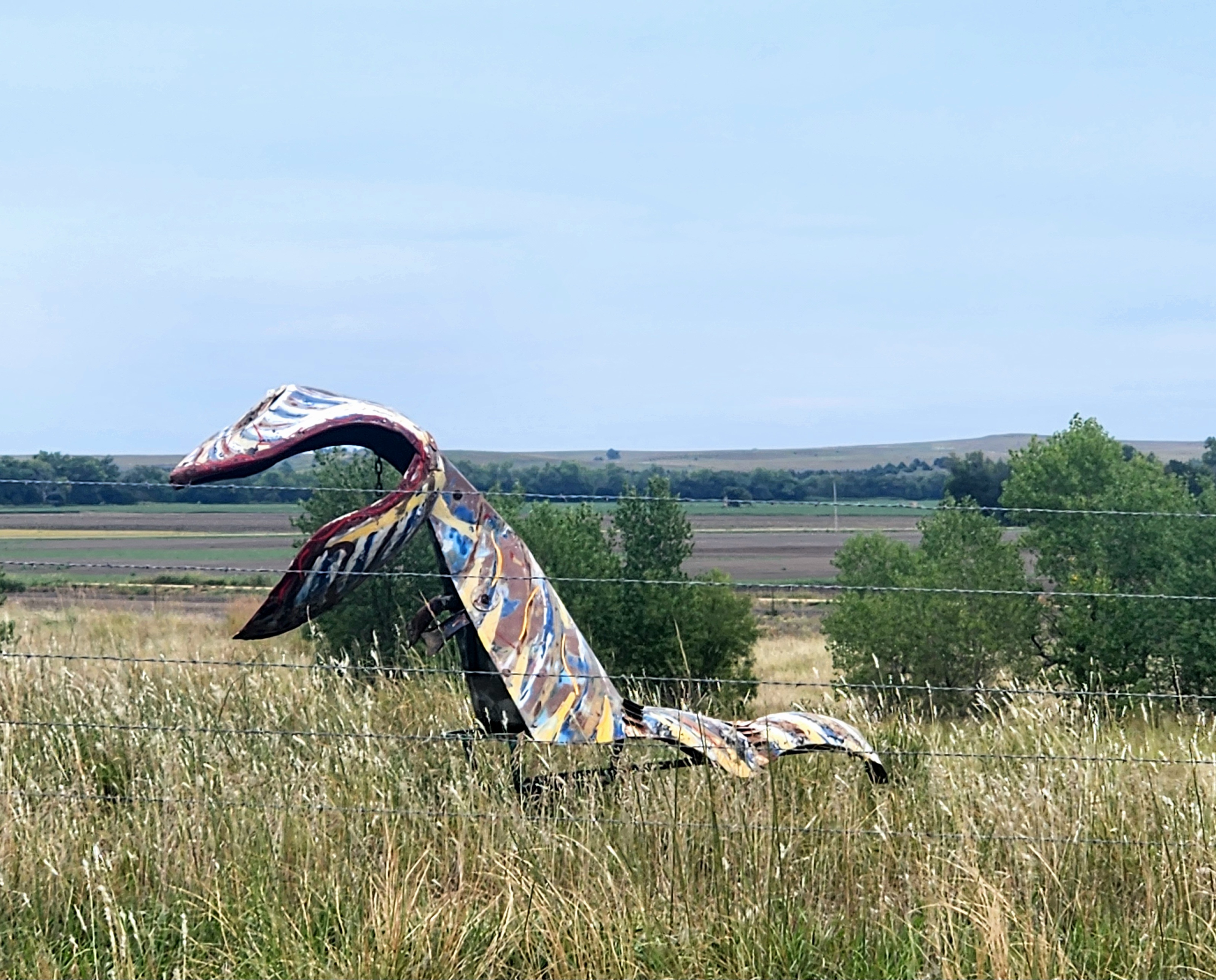
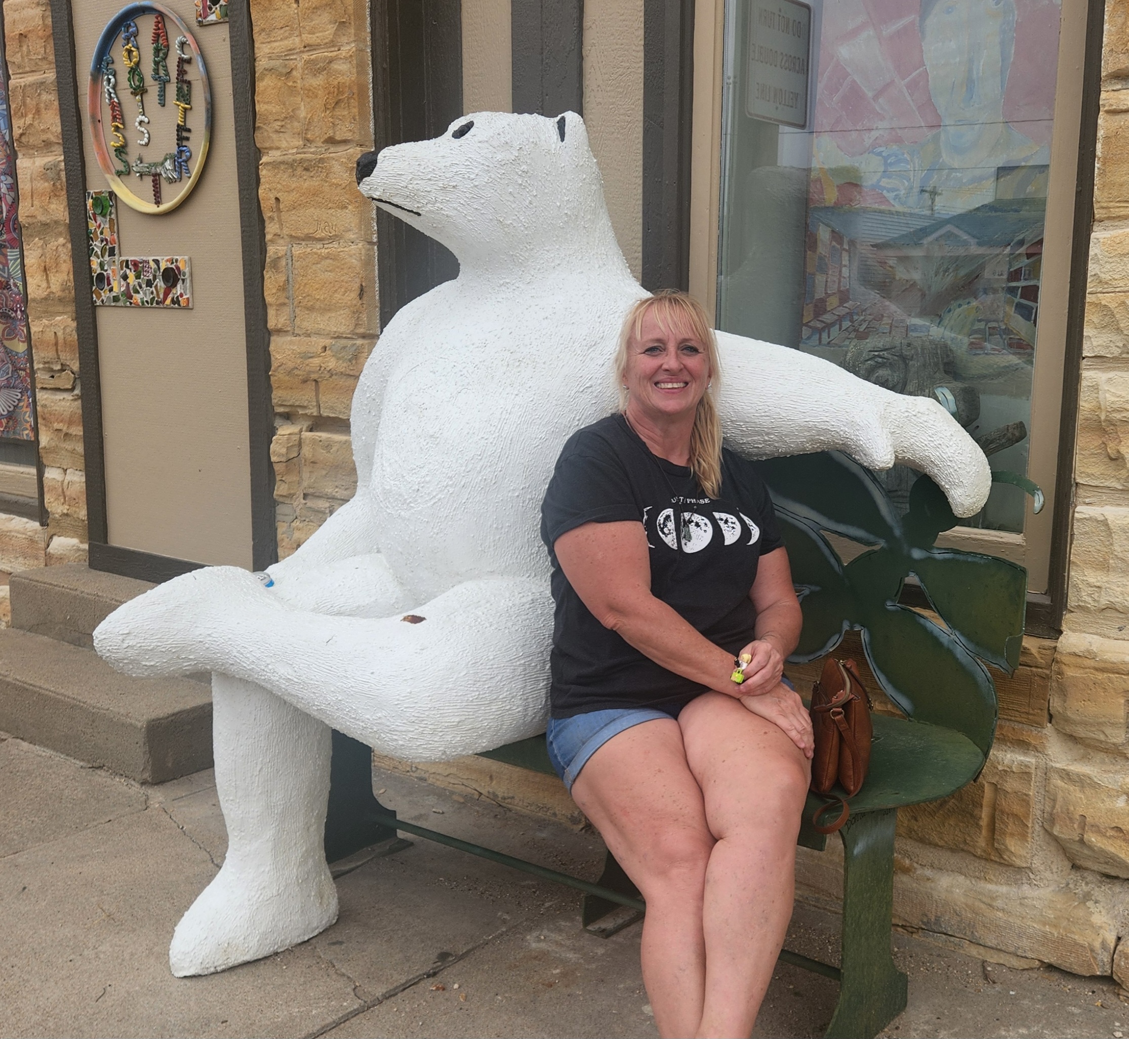
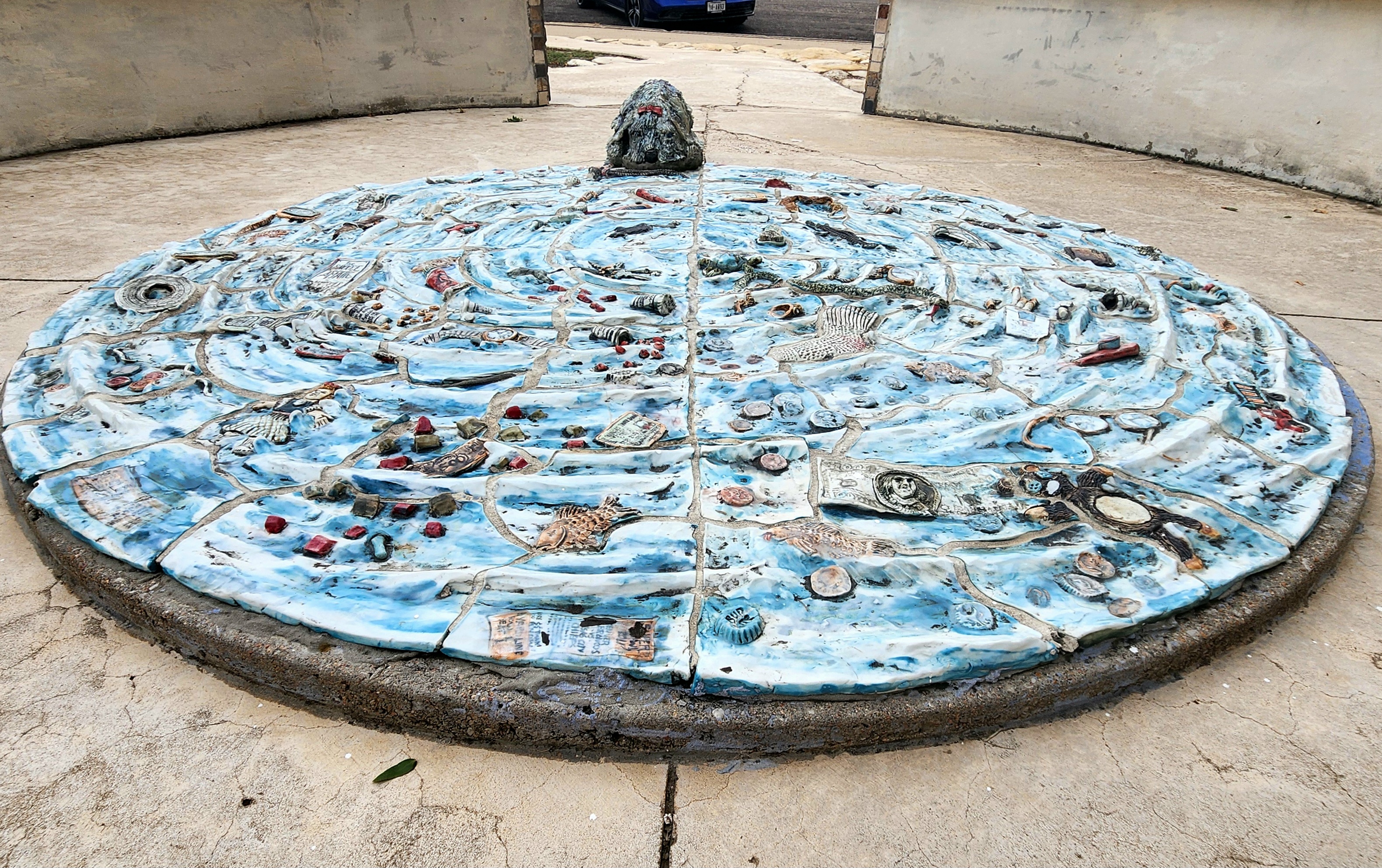
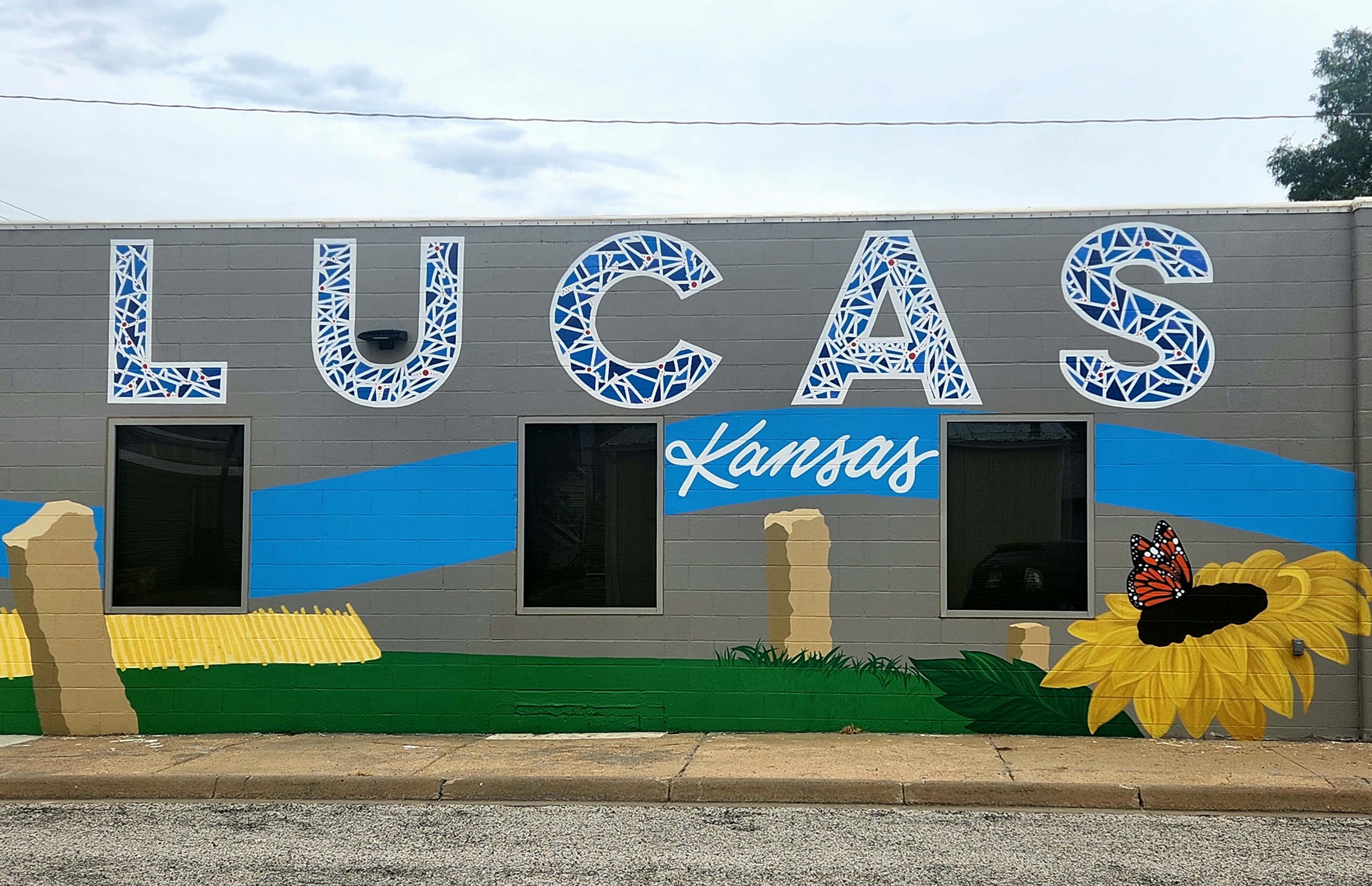
Backtracking a bit because I really have nothing but time and a list of unique sites to see, I headed north to Lincoln in search of public art in the form of dragons and other whimsical creatures along the highway between Lincoln and Lucas. In Lucas, I visited the highly anticipated but a skosh underwhelming World Famous Collection of the World’s Smallest Versions of the World’s Largest Things, an interesting retrospective of roadside America art. Lucas is home to more public art than inhabitants, including Bowl Plaza, a public toilet designed in the shape of a toilet bowl. The swirling water artwork in the middle punctuated with all the things that might be flushed (keys, money, alligators, hopes) and a dog lapping at the water. Dropping back south again toward Wilson, I traveled the very scenic road that hugs the shores of Lake Wilson and through gentle rolling hills, and back to I-70.
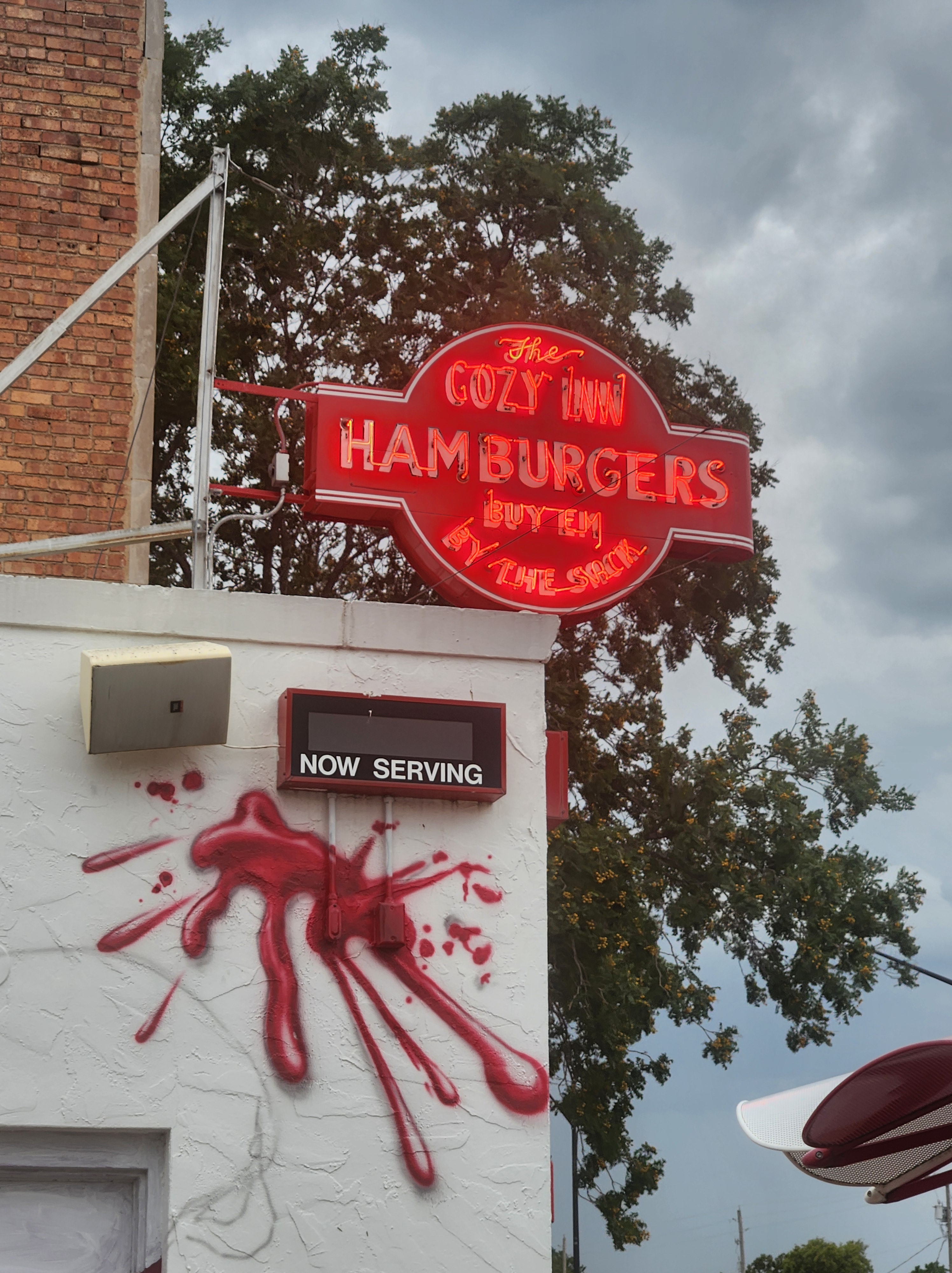
I abandoned my two-lane roads for the Interstate to press on to Salina in search of dinner and to contemplate a place to stop for the night, always keeping a vigilant eye on the dark clouds gathering along my route. The billboards along I-70 directed me to the award-winning Cozy Inn Hamburger Stand. The Cozy Inn sells hamburgers (sliders) by the sack, sacks of potato chips, and cans of soda, offering only a small counter inside doused in the smell of the grease from the grill and picnic tables outside for your dining experience. Making a hotel reservation for one of two remaining rooms in Abilene, I finished my dinner as the rain started to fall, and headed onward.
The rolling landscape of Kansas that I had become fond of traveling the little roads is lost on the Interstate. Interstates revolutionized car travel in America. As a cost, the small towns are bypassed, replaced by a smattering of restaurants and gas stations located near the interchange, all designed to minimize the amount of time a driver has to take on any break for food or gas. The benefits of the interstate system are many; however, I eschew them as much as possible. I find the two-lane roads with almost no traffic preferable to the cars and trucks zipping along the Interstate in mind numbing rhythm of wheels going over seams in the road and the cruise control set. I enjoy the drastic change in speed limits from 60 mph to 30 mph as you enter each small Kansas town, knowing that you absolutely need to adhere to the posted speed as the single town officer may be waiting there for those that don’t.


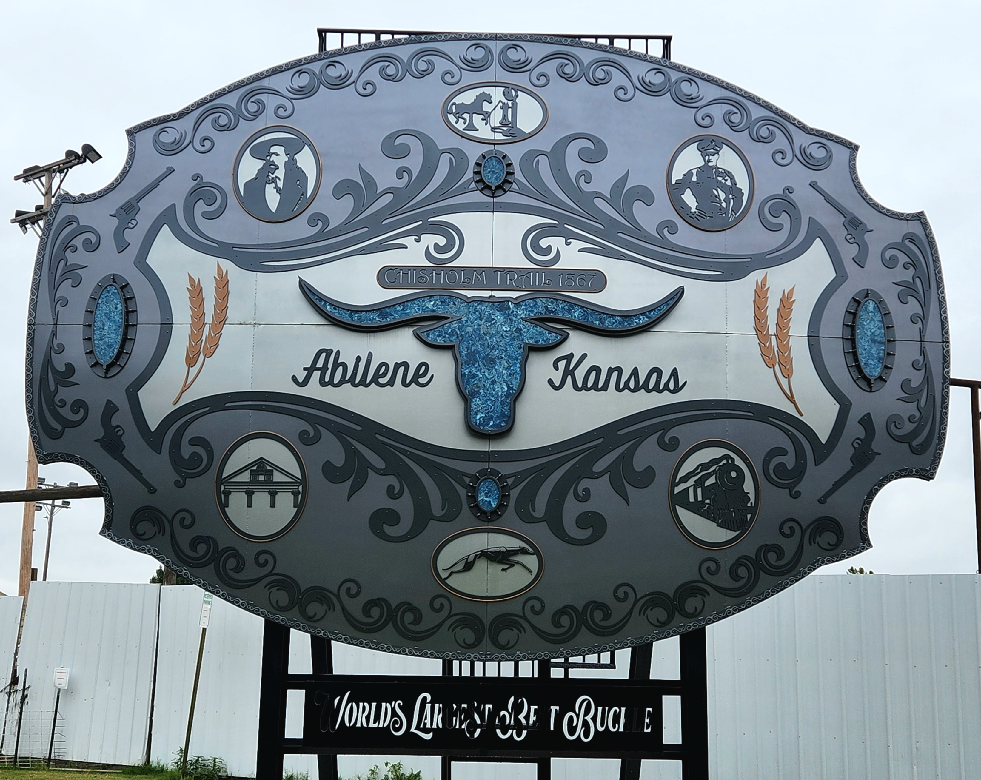
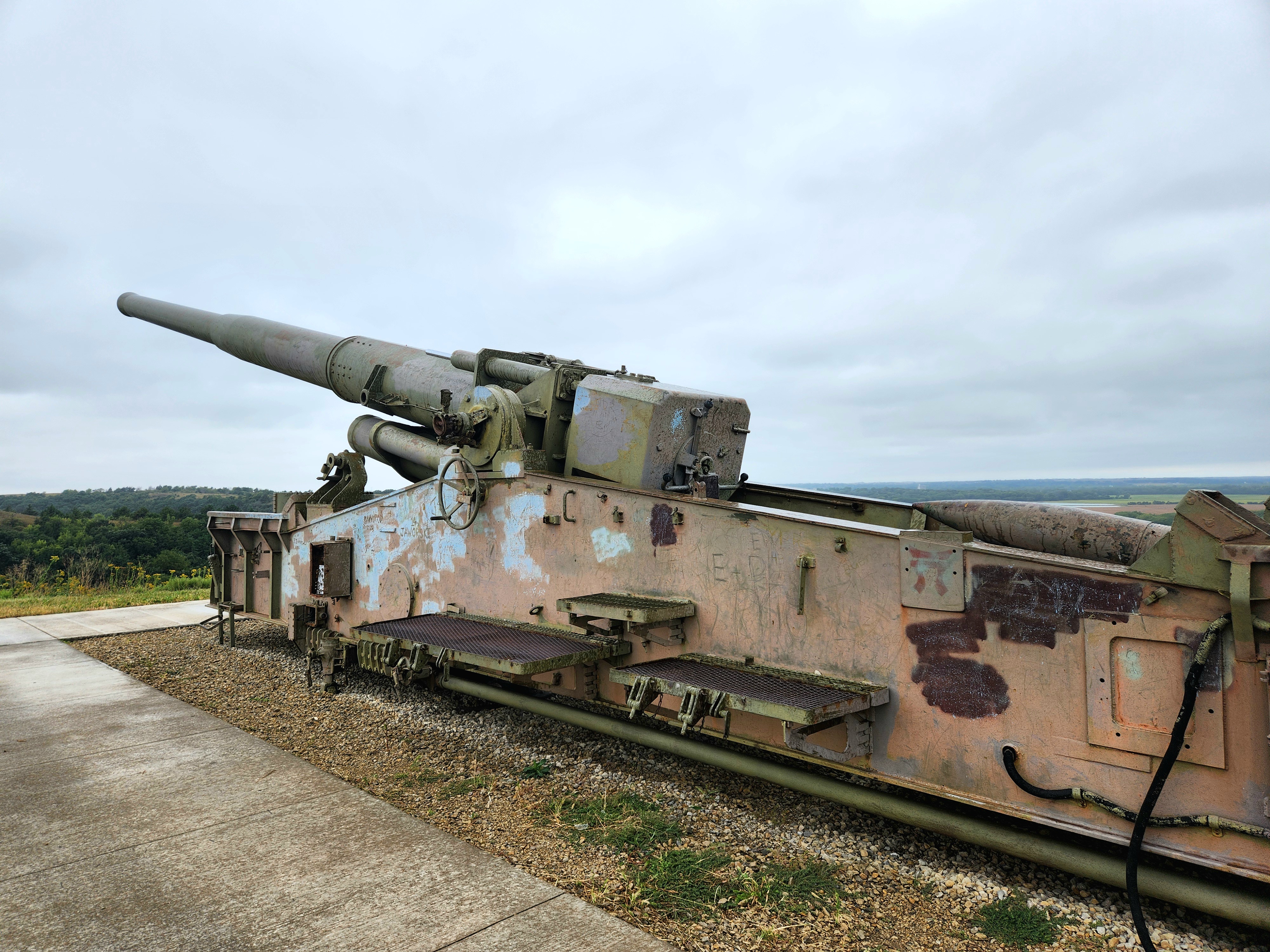
Gray skies and rain greeted me as I began my third day of travel. Weather doesn’t stop me from making my stops. A visit to a giant spur outside a Western wear store, an oversized “I LIKE IKE” campaign button standing amid the aftermath of a Oktoberfest celebration disrupted by wind and rain the night before, and the World’s Largest Belt Buckle sent me on my way. I climbed up the hill at Freedom Park just outside of Abilene to see the atomic cannon, a cannon capable of delivering a nuclear warhead but was never fired in combat. After falling on a slippery railroad tie near the top of the hill, I pondered my choice in footwear (sandals) as I limped the rest of the way down the hill with a pulled quad.
A brief pause in Manhattan allowed me to check out the statue of Johnny Kaw, a folklore hero birthed in 1955 by a horticulture professor that felt Kansas history was being ignored during Manhattan’s 100th birthday celebration, and touted as being bigger than Paul Bunyan (the statue in Minnesota) and having done more than Paul Bunyan.
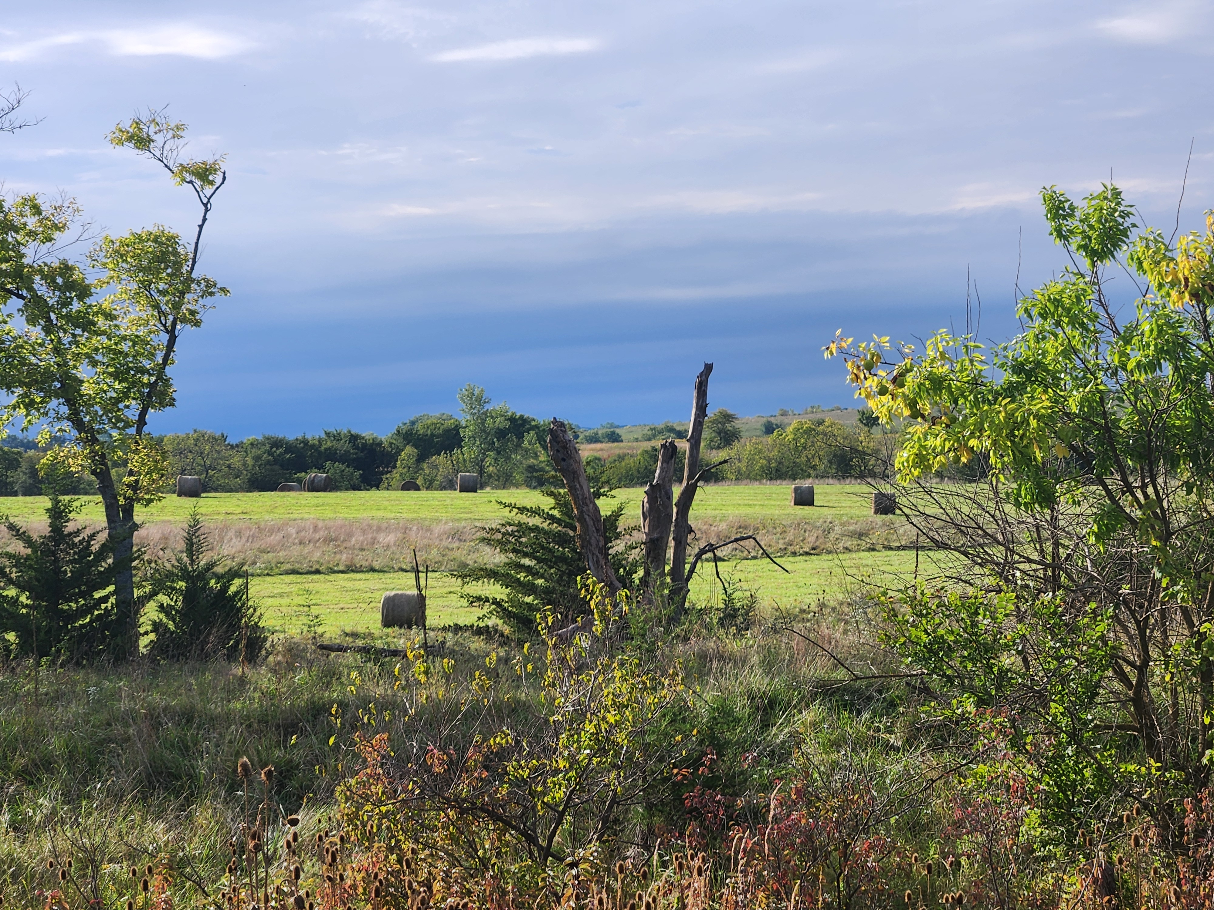
As I pressed eastward the landscape transformed from the dry, brown, mostly flat of western Kansas to the lush green rolling hills of the Missouri River valley. Fields of green winter wheat punctuated by harvested fields of soy beans with leaves turning a brilliant yellow replaced the dried up harvested fields. Stands of trees were everywhere, surrounding farms and lining the horizon in a band of dark green. The trees are starting to show the very beginning vestiges of the transition from verdant green to yellowish green, a precursor to the Fall colors to come.
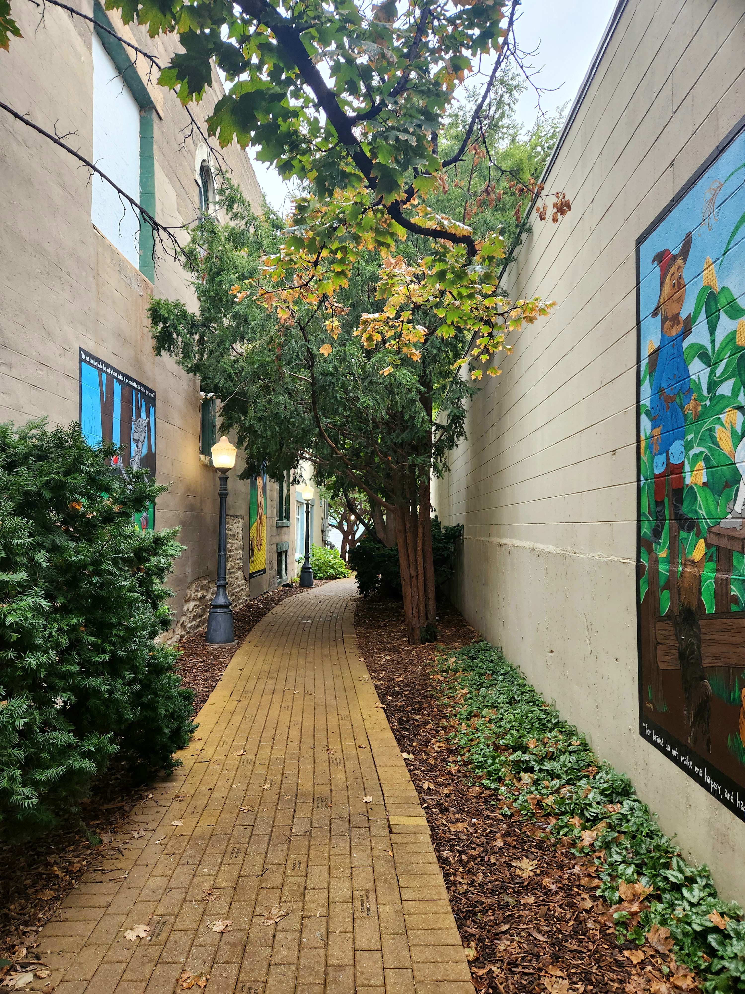
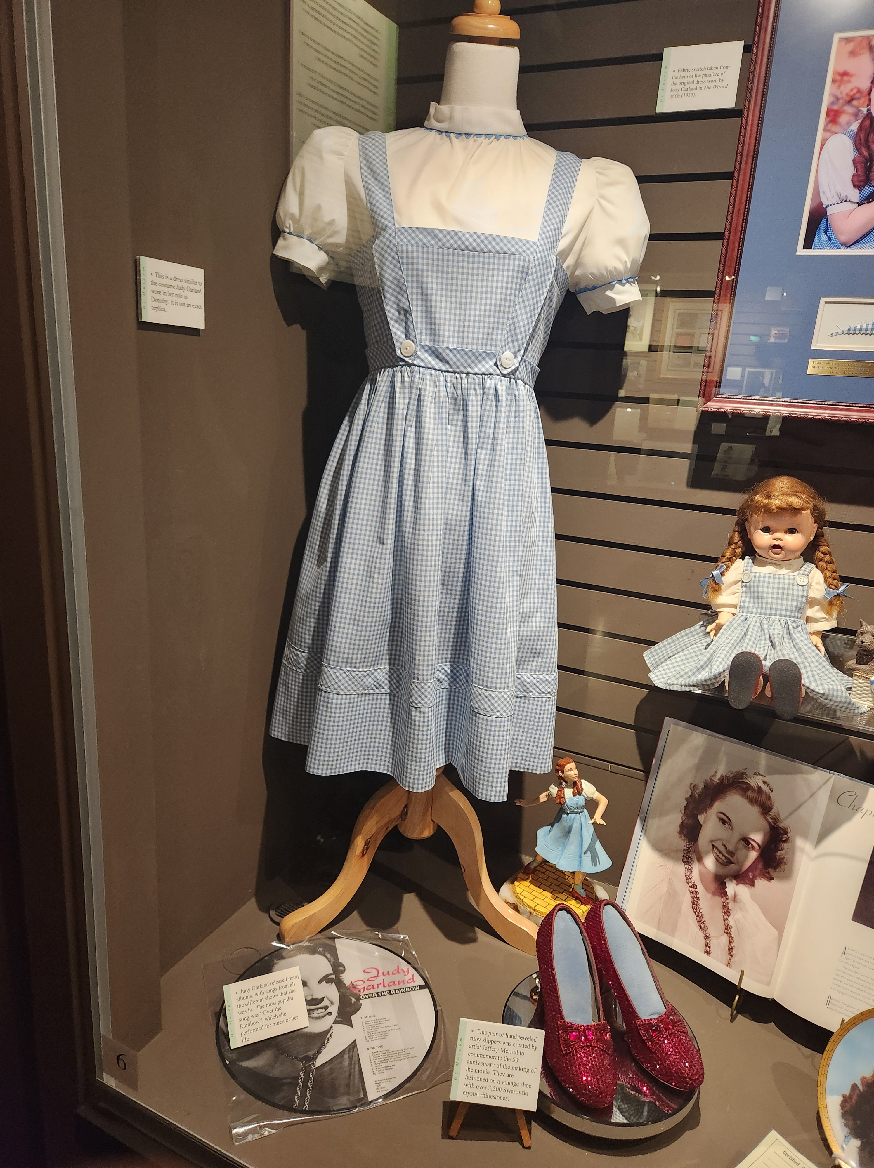
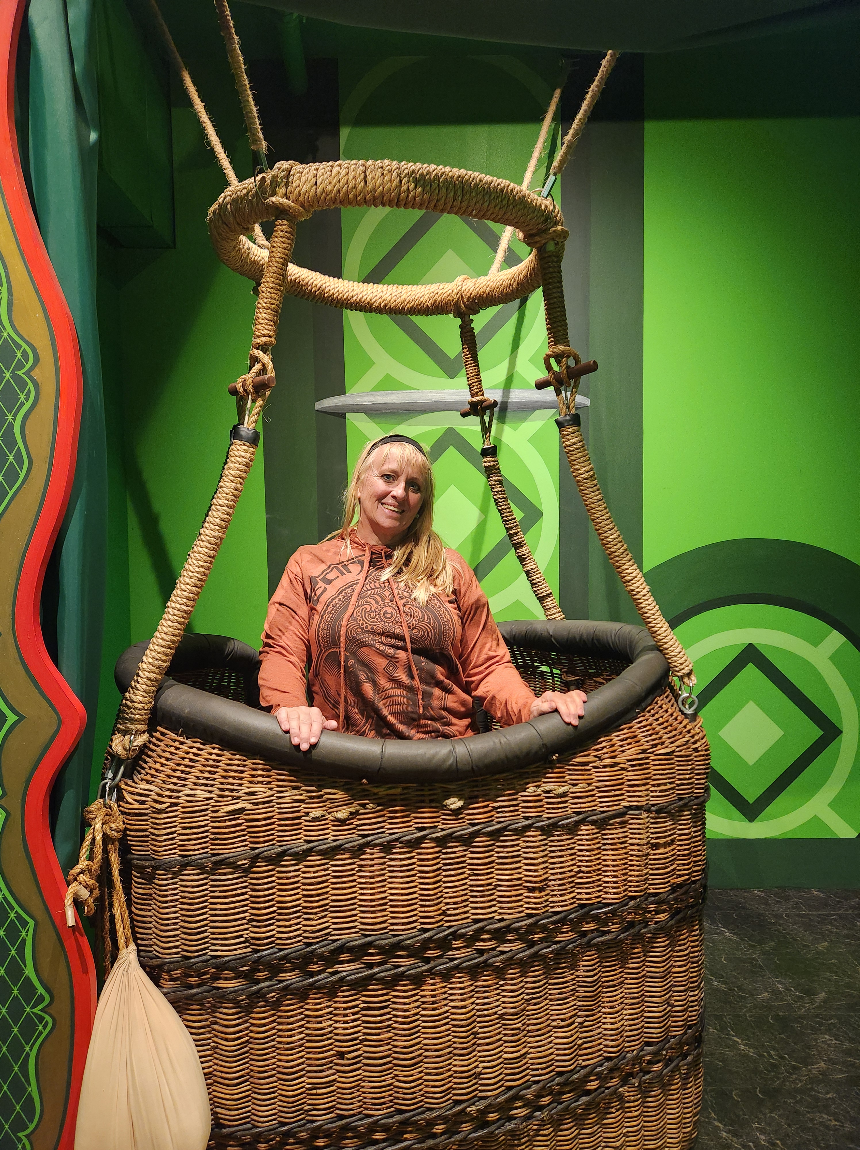
Taking my time, I enjoyed Wamego to the fullest. Home to all things Wizard of Oz, including being where Frank L. Baum was from. I took a walk on the Yellow Brick Road, a whimsical yellow brick path between two buildings with colorful murals and at lunch at Toto’s TacOz. The Oz Museum has a terrific collection of Oz memorabilia, documentaries telling about the making of the movie, and the original movie playing on continuous loop in a theater room. Before leaving town I stopped to taste wines at the Oz Winery, made locally with theme names such as “A Wine of a Different Color”, “Melted Merlot”, and “Run Toto Run”.
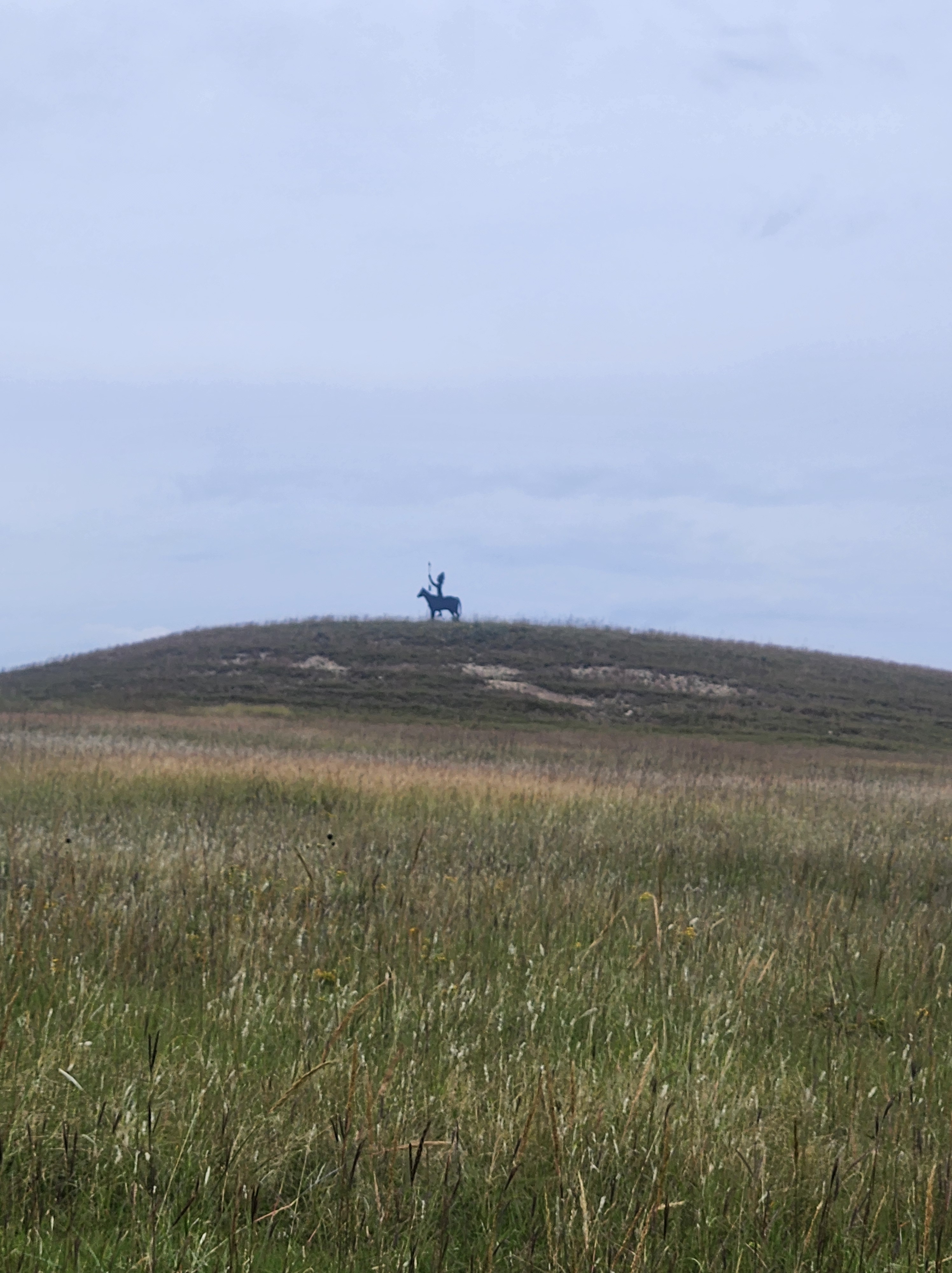
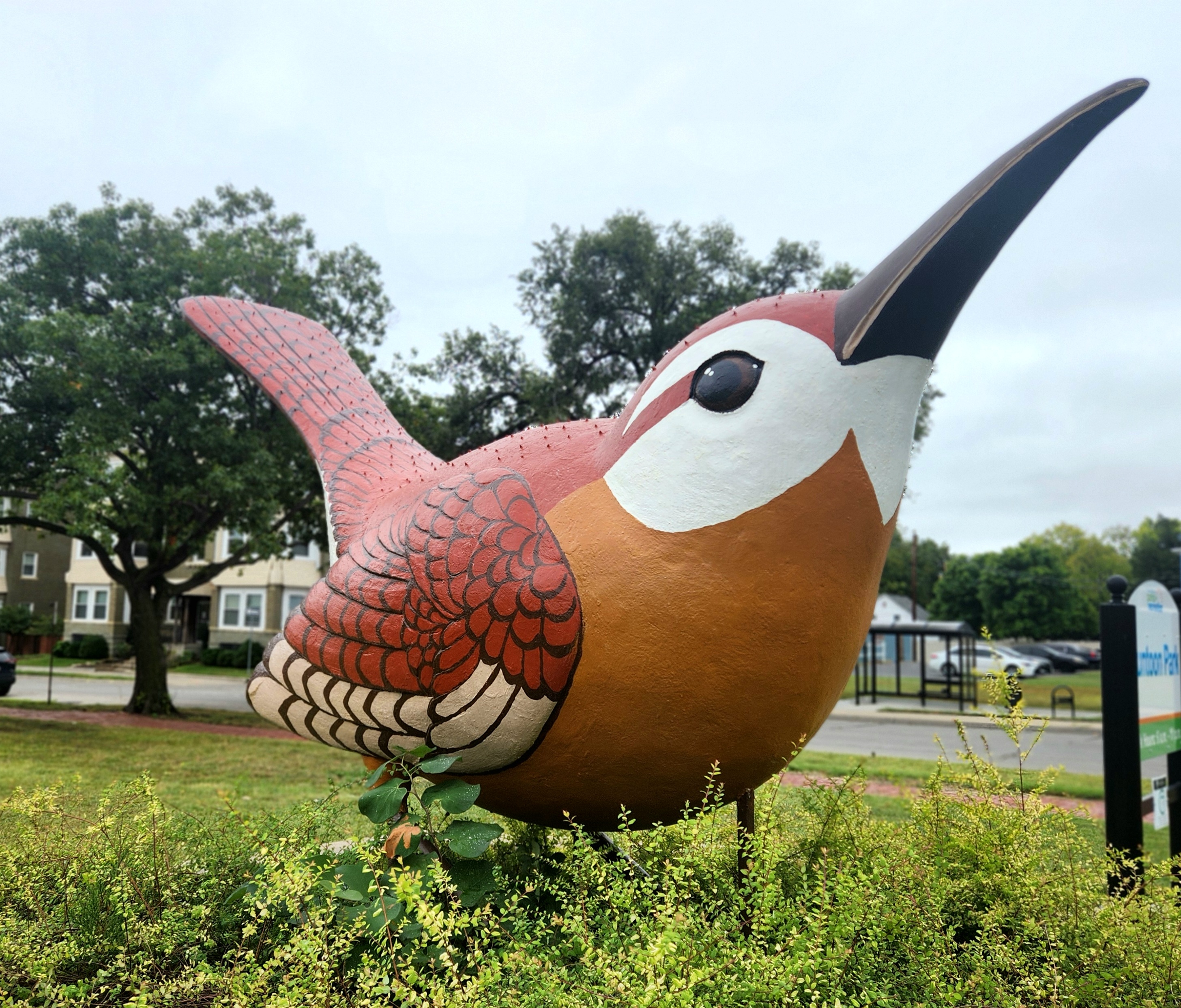
In Topeka, I admired the locally famous giant wren statue, went on a search for a statue of Dr. Still, the founder of osteopathy, that is no longer there, and took a quick walk in the damp and chilly air around the capitol building admiring statues of Lincoln, Ad Astera (the Indian atop the capitol building), and General Eisenhower. Leaving I-70 for good this time, I headed northeast. A combination of two-lane and gravel roads brought me to Muscotah, home of the World’s Largest Baseball, a watertower turned into a tribute to Jim Tinker.
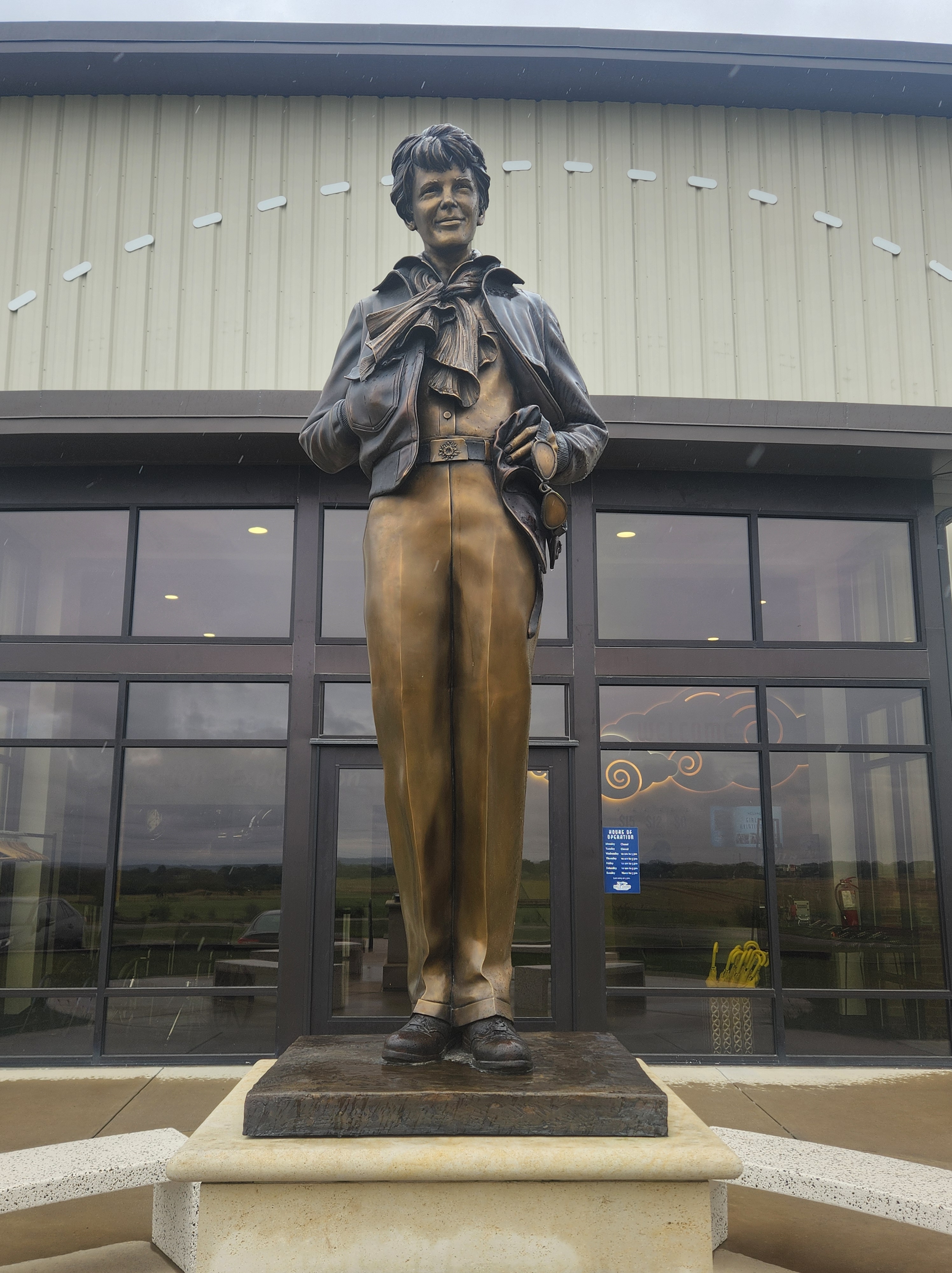
Pressing on, I headed to Atchison with the hopes of arriving before the Amelia Earhart Hangar Museum closed for the day. Despite the sign saying no admission after 4 PM, the bored workers let me in at 4:15 PM. The museum was fantastic! The centerpiece was the identical sister plane to the one that Amelia flew on her ill-fated trip around the world. The displays were a combination of the history of aviation, science of flight, and inspiration of an incredible woman. “Adventure in itself is worthwhile” is the Amelia Earhart quote that most resonated with me and my road trip.
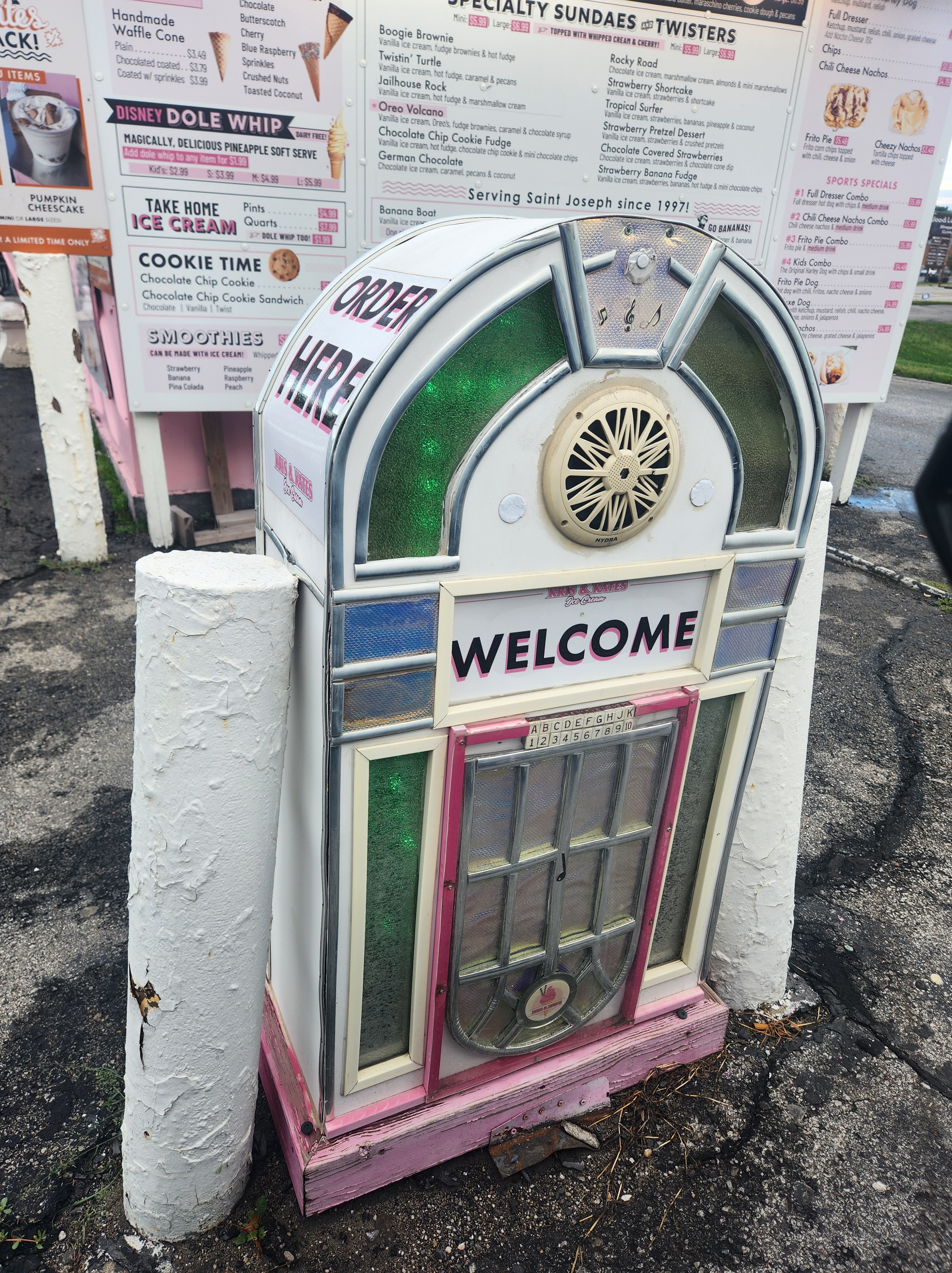
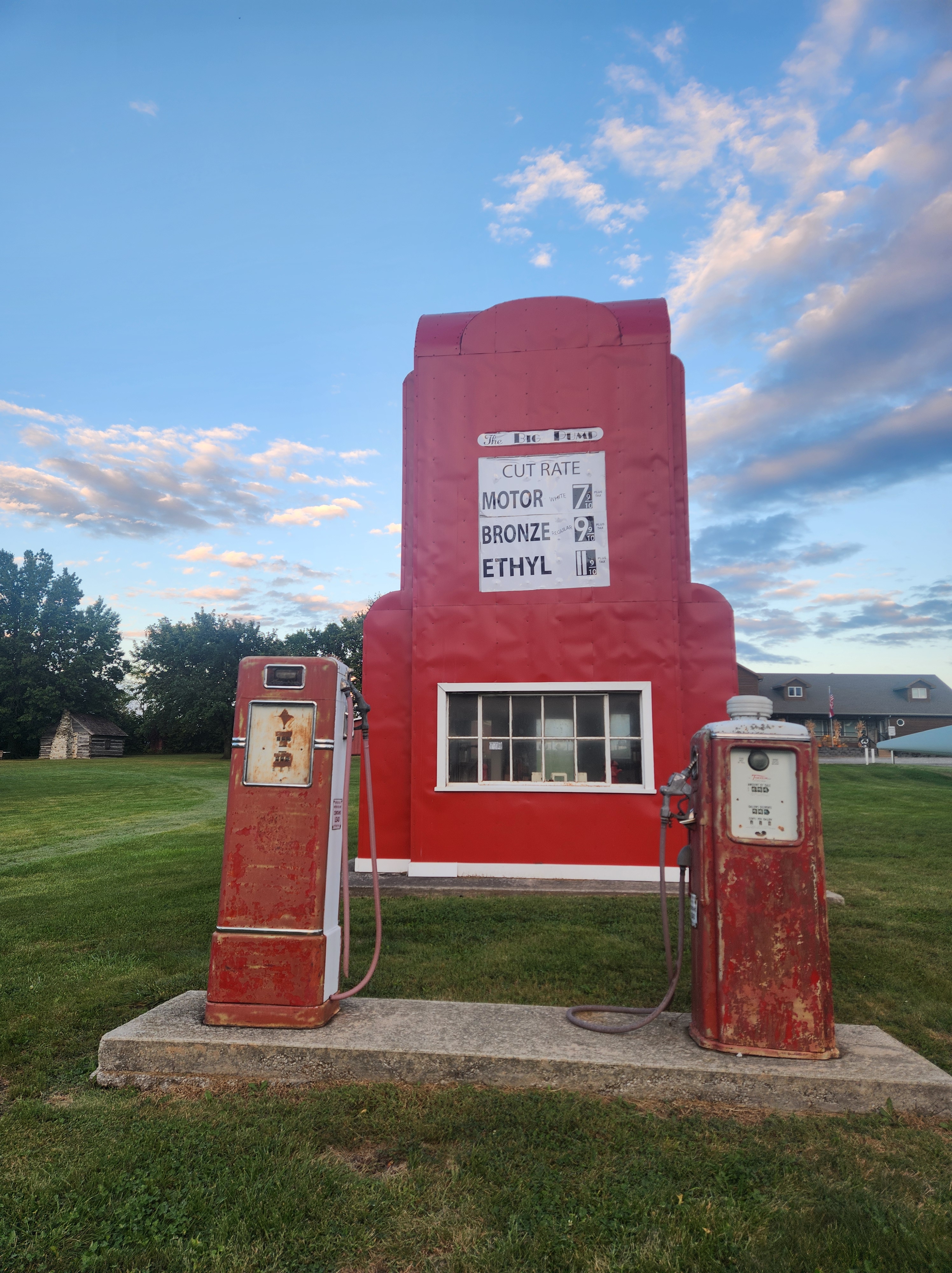
Crossing over the Missouri River, I left Kansas behind and entered Missouri. St. Joseph smells funny to me as the smell of what I’m guessing were pig farms hit my nostrils. Google Maps took me on a unique path to the Pony Express hotel sign, a vintage sign standing where the hotel used to be. On my way out of St. Joseph, I stopped at the building shaped like an ice cream cone and ordered ice cream from a drive through speaker made out of an old juke box. Heading northward, in King City I stopped at the Big Pump, a building shaped like a gas station that actually was a gas station until the gas crisis of 1979. Accompanying the building were two impressive and massive blades from the windmills that dot the countryside. Each blade is almost 142 feet long with a diameter of just under 7.5 feet! The sun was setting as I headed into Stanberry, and despite my readiness to be done for the day, I did stop to take a picture with a metal cow by the side of the road. With camping options limited and darkness settling in, I stopped at a motel in Albany for the night.


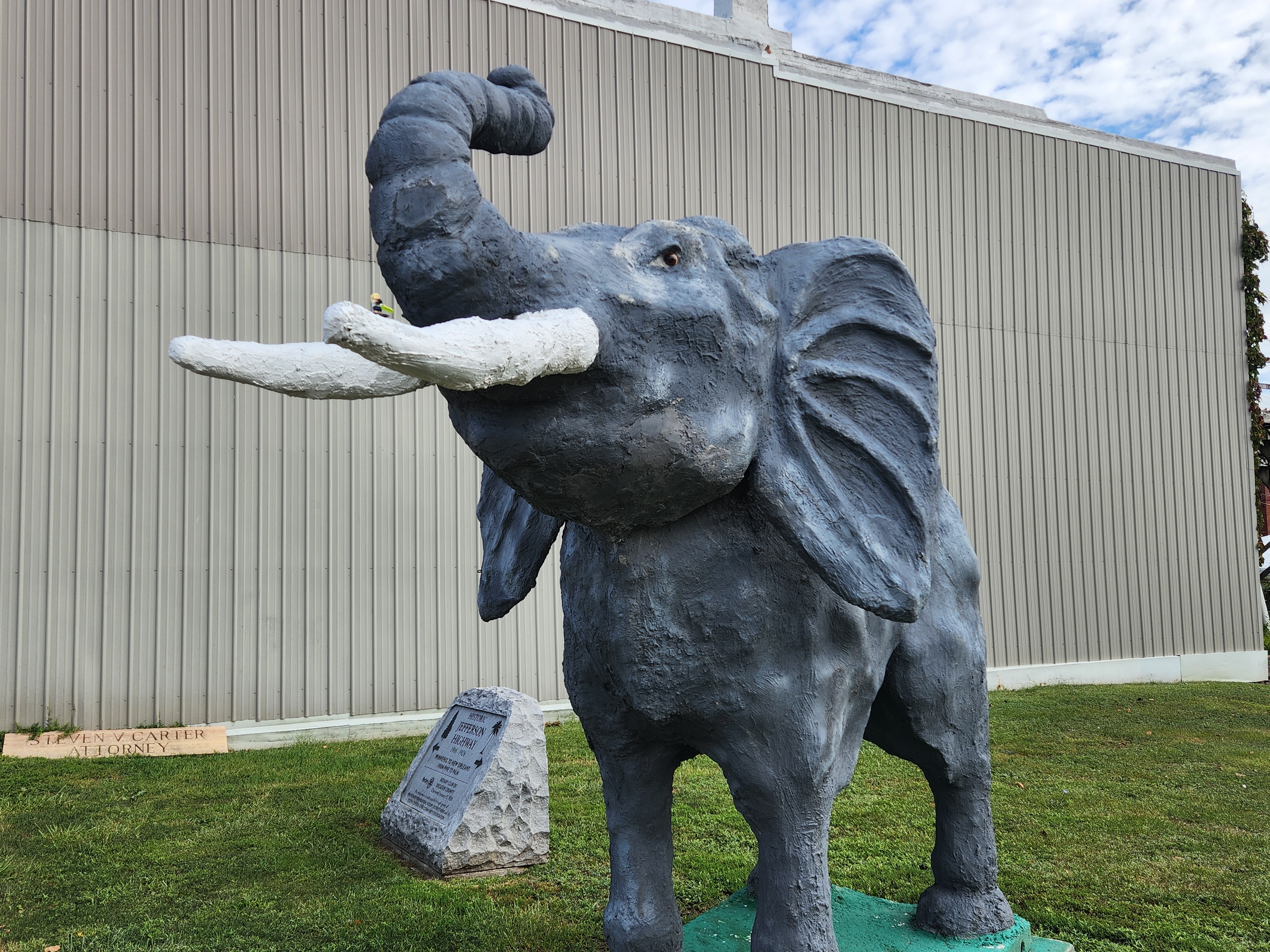
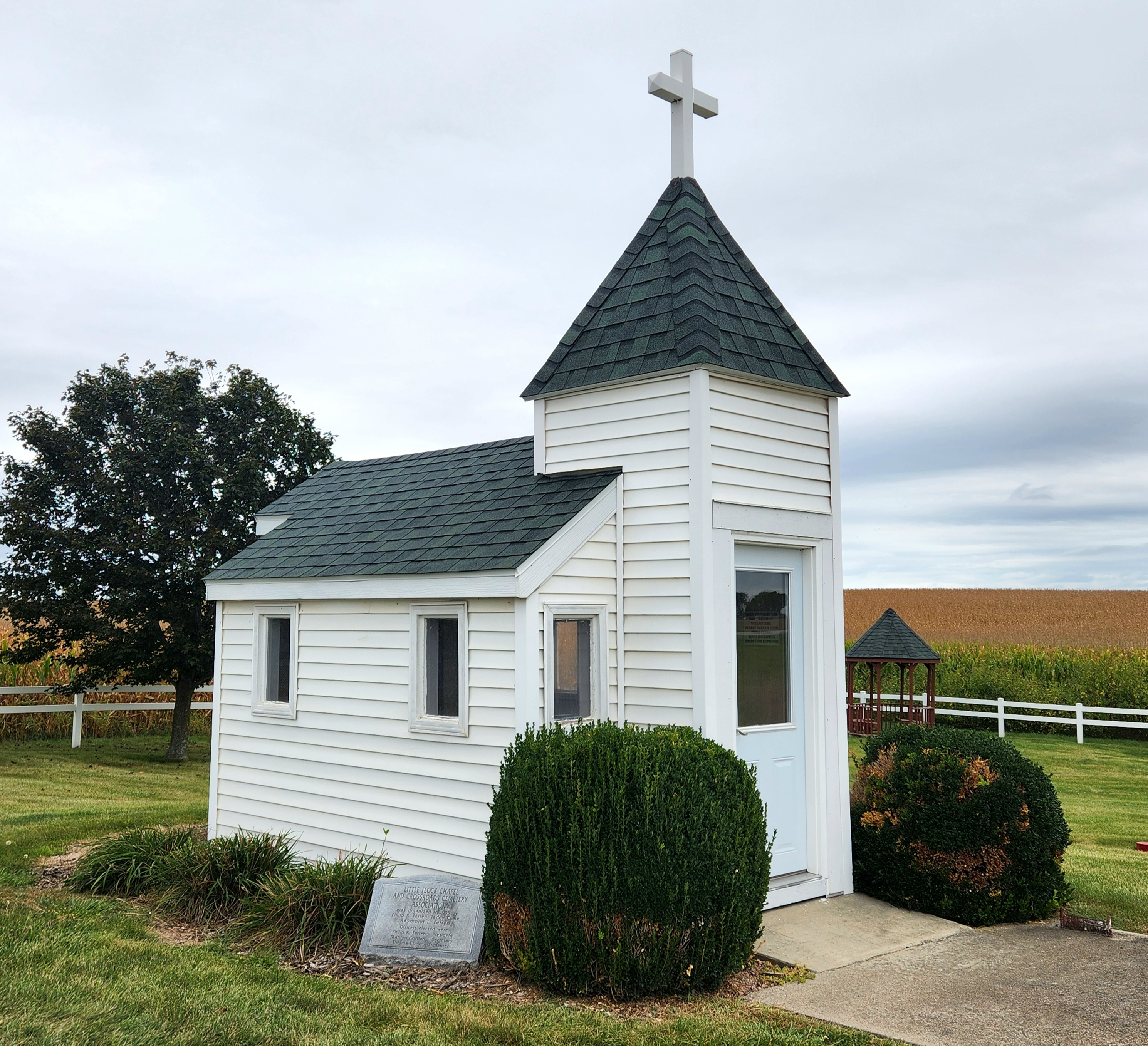
Day four of my road trip through the heartland brought me clear blue skies and had me heading more directly north on I-35, passing over the Iowa state line and then heading east to start my zigzag path through southeastern Iowa. In Leon, I found an old elephant statue standing on the corner. I paused at the mural in Corydon, learning that it was the site of a Jesse James robbery, and came to a screeching halt when I found the white metal dinosaur skeletons standing by the side of the road. Little Flock Chapel stands at an intersection near Plano, the diminutive building painted in white and looking picturesque among the green fields. Heading northeast, I stopped in Avery where there are pyramid shaped tombs that look distinctly out of place in the small cemetery along the gravel road.
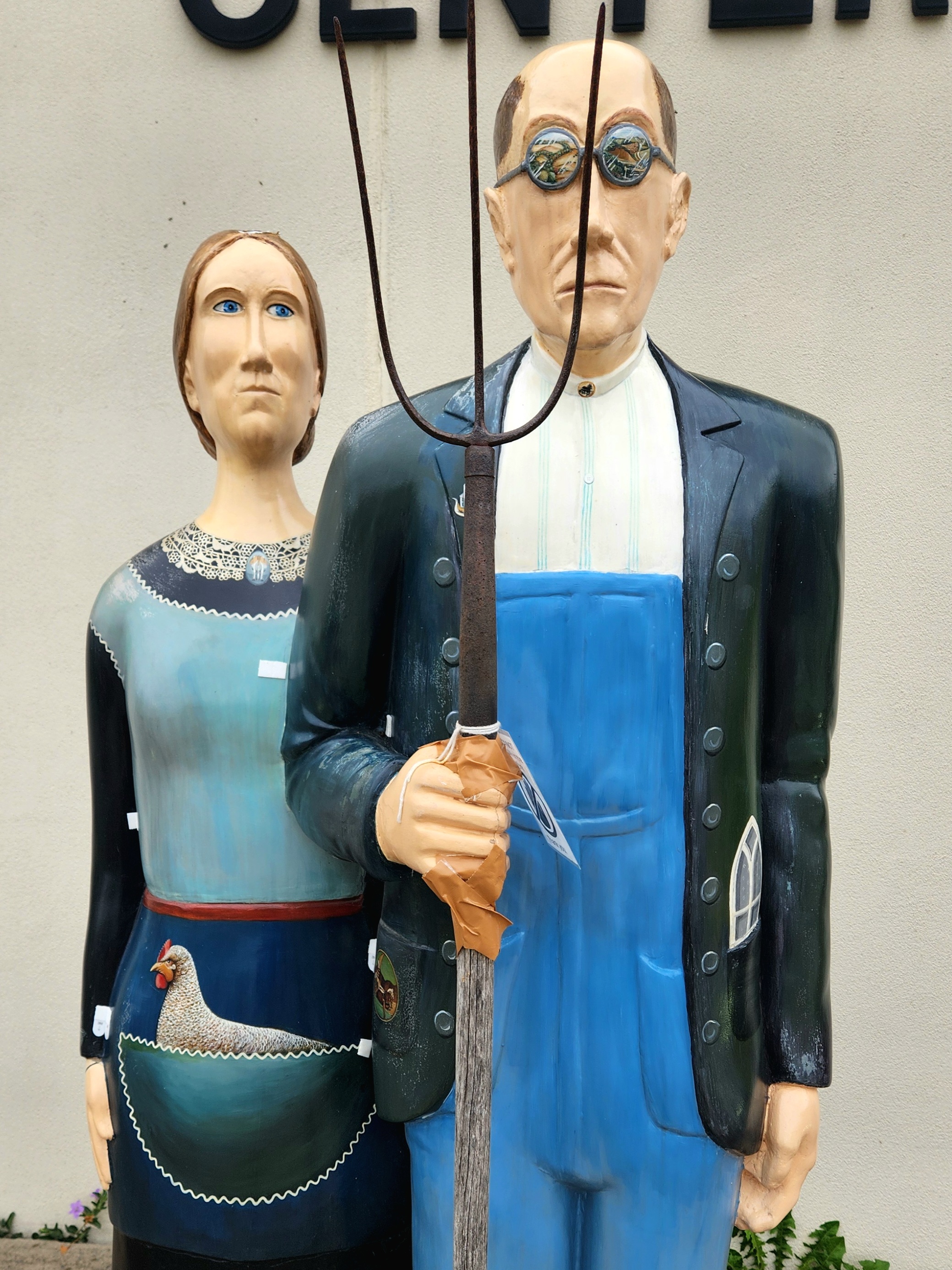
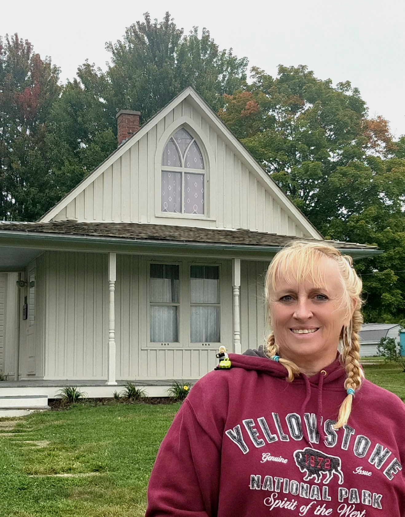
More gravel roads took me winding through the Iowa countryside over the Cry Baby bridge, the site is purported to be haunted and lore telling that you can hear the cries of a baby that was thrown off the bridge, and up to Mars Hill church. Mars Hill is the oldest log cabin church east of the Mississippi and was used as a stop on the underground railroad. Then because I was in the area, I decided I needed to visit Eldon, the site of the house in Grant Wood’s American Gothic painting. The house being located near the patchwork of fields in the painting.
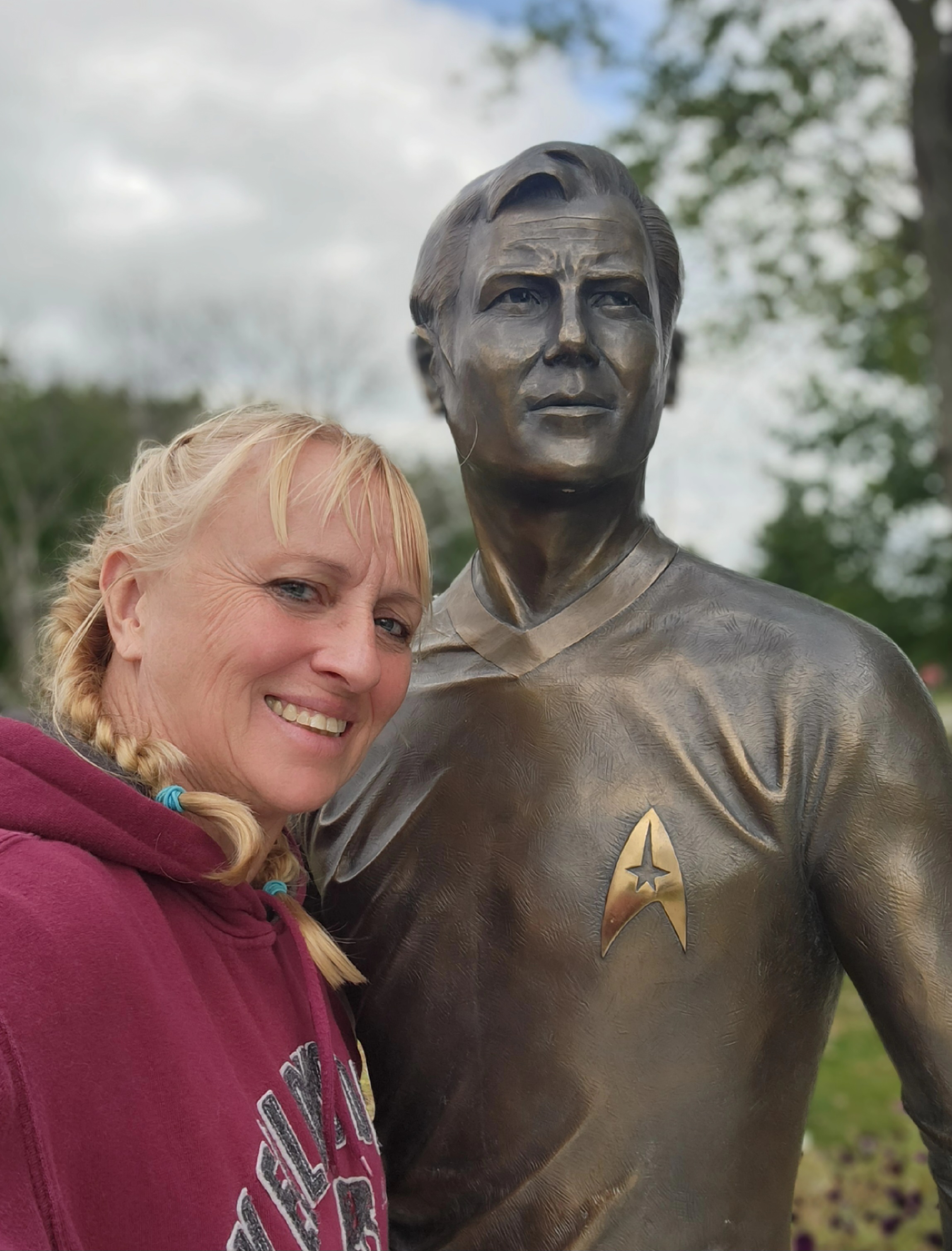
Zig zagging my way northeastwardly brought me to Hal Collier’s Sign Extravaganza outside of Keota. After an affectionate greeting by Mindy Lou, the old and gentle host dog, I took a stroll around the property where every farm building was covered with signs of all manner, and listened to the old metal gas signs creak in the wind as they stood by their accompanying gas pumps. At Hal’s encouraging, I took a tour of the inside of the garage which was filled to the brim with even more signs. Pressing onward and knowing I was close to my destination, I stopped in Riverside. Despite living less than 20 miles from Riverside in my youth, I had never stopped at the future birthplace of Captain James T. Kirk.
1068 miles after turning on to Colfax Street four days prior, I reached Iowa City. My car covered in dust from gravel roads and mud from camping, I pulled into the driveway and turned off the engine.